
Wikimedia Commons / CC-BY-SA-3.0 / GFDL
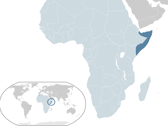
Capital: Mogadishu
Population: 20 million+
Language: Arabic/Somali
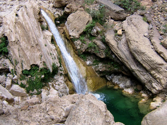
1 – Lamadaya Waterfalls (above)
Tucked into a gorge in the highlands behind Somalia’s northern coast, Lamadaya is the country’s largest waterfall and one of the very few anywhere in it that runs all year — water falling steadily in a land where almost every riverbed spends most of the year dry.
The stream drops in a chain of cascades down sheer ochre cliffs into deep, cold plunge pools at the bottom, reached along rough tracks and a scramble over rock; herders bring livestock down to drink, and families come up from the hot plains to swim and picnic in the spray.
The name is a warning rather than a description: Lamadaya means roughly “not to be looked at” in Somali — a reference to the giddy drop at the lip of the fall, where the edge comes without warning and looking down is a bad idea.
2 – Laas Gaal Paintings
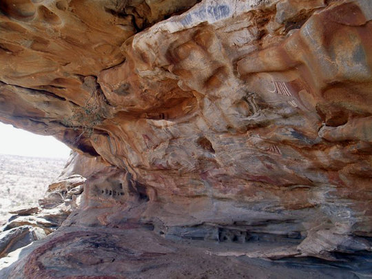
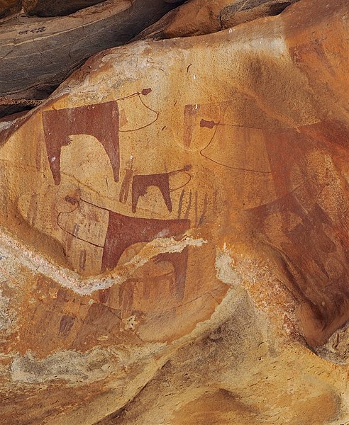
On a granite hill in the dry countryside outside Hargeisa, in the northern region of Somaliland, the caves of Laas Gaal hold some of the oldest and best-preserved rock art in all of Africa — vivid Neolithic paintings made by cattle-herding people some 5,000 or more years ago.
Sheltered from the elements in a series of rock alcoves, the paintings glow almost as freshly as if newly finished — long-horned cows with ornately decorated necks, alongside herders, dogs, giraffes and antelope, a window onto a time when this parched land was green savanna; they’ve been called the “African Lascaux.”
Astonishingly, the paintings survived unknown to the wider world until 2002 — the local nomads had known of the caves for generations but shunned them, believing the shelters to be haunted by spirits, until they finally led a team of French archaeologists to the site. Laas Gaal can’t become a UNESCO World Heritage Site because Somaliland isn’t internationally recognised.
3 – The Cal Madow Mountain Range
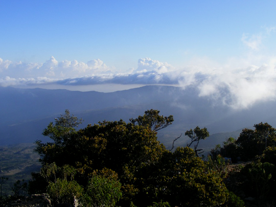
Rising steeply above the arid coast of the Gulf of Aden, the Cal Madow range is the roof of Somalia — crowned by Mount Shimbiris (around 2,460m), the country’s highest peak — and a startling ribbon of cool, misty highland in a land of desert.
Catching the sea fogs and rains, its heights hold some of the last ancient juniper forests in the Horn of Africa, alongside hundreds of plant species found nowhere else on Earth and rare creatures like the little beira antelope and the Warsangli linnet, a finch that lives only in these mountains.
These dry, aromatic slopes are one of the ancient homes of frankincense — the fragrant resin, tapped from the gnarled Boswellia trees that cling to the rocks here, has been traded for thousands of years, burned in the temples of Egypt and Rome and carried, so the story goes, by the Three Wise Men.
4 – Kismayo Beach
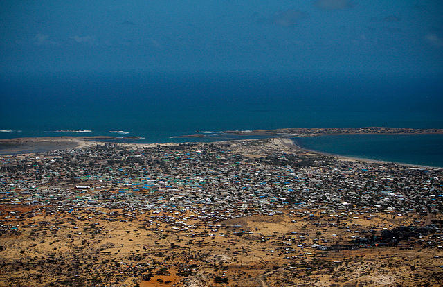
On Somalia’s southern coast, where the Jubba River empties into the Indian Ocean, the port city of Kismayo is fringed by long, powder-white beaches lapped by warm turquoise water — a place with a deep past as a trading town of the Swahili coast, once ruled from Zanzibar and fought over by sultans and empires.
Its palm-lined shore and dunes give way to a bustling old port and a maze of coral-stone streets, while just offshore lie the Bajuni Islands, a scattering of tiny, near-untouched coral islets ringed by dazzling sand and clear, fish-filled water.
Kismayo’s beach is just one jewel on an astonishing shore — Somalia has the longest coastline of any country on the African mainland, some 3,300km of largely empty, pristine white-sand beaches that the wider world has barely glimpsed.
5 – The Citadel of Gondershe

On a rocky headland on the Indian Ocean coast south of Mogadishu stand the weathered ruins of Gondershe — a medieval stone city that, centuries ago, was a thriving port of the great Somali sultanates, one of a string of coral-built trading towns that once lined this coast.
Built of coral rag and lime, its tumbledown houses, mosques, tombs and the old fortress, or “citadel,” that gives it its name recall an age when this shore was a busy node of the Indian Ocean world, trading with merchants from Arabia, Persia, India and as far away as China.
Gondershe is no empty ruin — a small fishing community still lives among its ancient coral walls, casting their nets from the same beach their forebears did, so that the medieval stone city has never entirely died, only quietly faded.
6 – Mogadishu
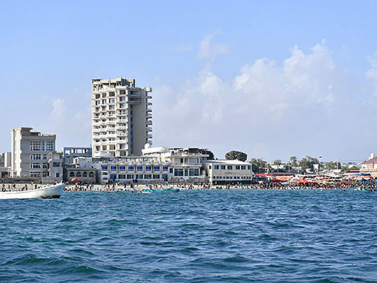
Somalia’s capital stands on the Indian Ocean and has been a city for a very long time: by the 13th century it was an independent sultanate and among the wealthiest trading ports on the whole East African coast, dealing with Arabia, Persia, India and China — the Arba’a Rukun and Fakr ad-Din mosques both date from 1269 and both still stand.
The old quarters of Shangani and Hamarweyne hold what remains of that coral-stone city, along with the shell of the Italian cathedral of 1928; inland spreads the vast Bakaara market, and on Fridays the city comes out to Lido Beach, where the surf rolls in off the ocean.
When Ibn Battuta landed here in 1331 he found a city so big it took days to cross and so protective of its trade that visiting merchants were each assigned a host — and he singled out the cloth woven here, which was exported as far as Egypt and known abroad simply by the name of the city that made it.
7 – Berbera
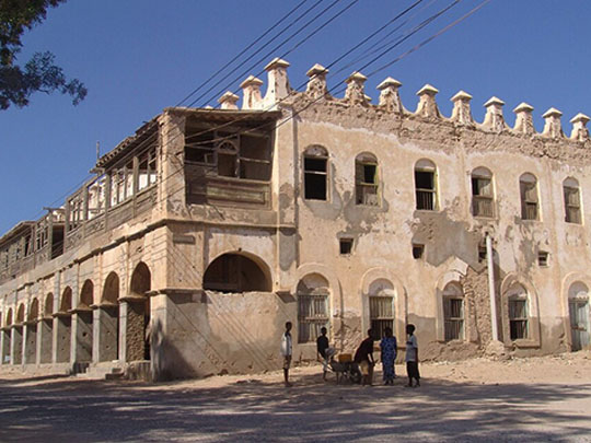

This port on the Gulf of Aden has been shipping livestock, hides, gum and frankincense across to Arabia for centuries, passing from Ottoman to Egyptian to British hands — it served as the first capital of British Somaliland, and each winter a great trading fair drew thousands of merchants from both sides of the sea.
The old town is a quiet ruin of coral-stone houses with carved wooden shutters and shaded verandas, much of it slowly collapsing into the sand, with a working port at one end and some of the least-visited beaches and coral reefs in the Indian Ocean at the other.
Berbera’s runway is more than four kilometres long, among the longest in Africa — built by the Soviet Union in the 1970s, taken over by the Americans after Moscow switched sides and backed Ethiopia in 1977, and then designated by NASA as an emergency landing strip for the Space Shuttle.