

Wikimedia Commons / CC-BY-SA-3.0 / GFDL
Capital: Sri Jayawardenepura Kotte
Population: 21.7 million+
Language: Sinhala and Tamil
1 – Sri Pada (Adam’s Peak) (above)
Sri Pada, or Adam’s Peak, is a 2,243-metre cone in the south of Sri Lanka’s hill country, with a hollow near the summit shaped like a giant footprint that four faiths have claimed: the Buddha’s left foot, Shiva’s, Adam’s first step after the fall from Eden and, for some Portuguese Christians, St Thomas’s.
The pilgrimage season on Sri Pada runs from the December full moon to Vesak in May, and most people climb overnight from Dalhousie, up something like 5,500 steps lit all the way, to reach the shrine before dawn — the same ascent Ibn Battuta described in 1344, hauling himself up by iron chains.
The famous sight from Sri Pada is the peak’s shadow at sunrise, a perfect triangle thrown across the clouds to the west, which is usually explained as a quirk of the mountain’s shape but is really perspective — any peak’s shadow looks triangular to someone standing on top of it; Adam’s Peak just has the crowd and the cloud to show it off.
2 – Sigiriya Rock
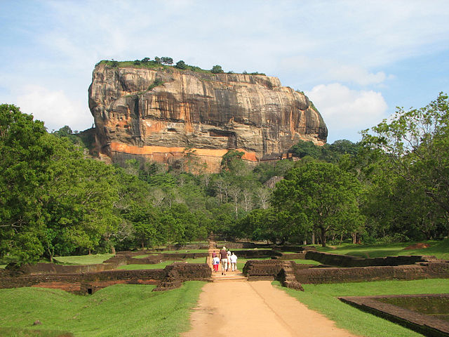
Sigiriya is a granite column rising about 180 metres from the plains of central Sri Lanka, and according to the Culavamsa chronicle it was the fortress-palace of King Kashyapa, who seized the throne in 477 by walling up his father alive and ruled from the summit until 495, when his half-brother came back with an army.
You climb Sigiriya past the water gardens, up spiral stairs to a sheltered gallery of painted women — around twenty survive — and through the Lion Gate, where two giant brick paws are all that’s left of the lion whose open mouth once formed the entrance, to the ruined palace on top.
The Mirror Wall halfway up Sigiriya is covered in verse graffiti from about the 8th to the 10th centuries — visitors writing poems to the painted women, in effect the world’s earliest tourist reviews — and the scholar who published 685 of them in 1956, Senarath Paranavitana, later claimed to read hidden inscriptions between the lines that no other epigrapher has ever been able to see.
3 – Temple of the Tooth – Kandy
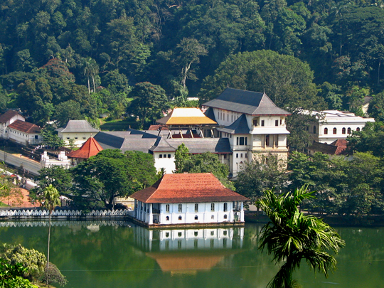
The Temple of the Sacred Tooth Relic, Sri Dalada Maligawa, stands beside the lake in Kandy, the last royal capital of independent Sri Lanka, and holds what Buddhists venerate as a tooth of the Buddha, said to have been smuggled from India in the 4th century in a princess’s hair — owning it proved a king’s right to rule.
The Temple of the Tooth keeps the relic in seven nested caskets, shown in public only rarely — the April 2025 exposition was the first in sixteen years — and each August the Esala Perahera parades a replica casket through Kandy on an elephant; on 25 January 1998 an LTTE truck bomb at the entrance killed 16 or 17 people, and the inner shrine survived.
In 1561 the Portuguese in Goa announced they had captured the Temple of the Tooth’s relic and had the Archbishop grind it in a mortar and burn it, turning down a fortune from the king of Burma — Kandy’s answer was that they had destroyed a replica, and for a while at least three rival teeth circulated.
4 – Dambulla Cave Temple
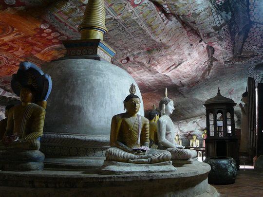
The Dambulla Cave Temple is a set of five caves under an overhanging rock in central Sri Lanka, used by monks since at least the 3rd century BC, and tradition says King Valagamba sheltered here in exile in the 1st century BC and turned it into a temple once he regained his throne.
Inside Dambulla the caves hold more than 150 Buddha statues, including a reclining Buddha about 14 metres long, under some 2,100 square metres of painted ceilings, and the World Heritage Site is those caves — the gold Buddha on the modern temple at the bottom of the hill, built around 2000, stands outside it and UNESCO has called it alien to the complex.
The name confuses everyone: Dambulla was listed as the “Golden Temple of Dambulla” until 2019, which sounds like a reference to the gold Buddha but is eight centuries older — it comes from the 12th-century King Nissanka Malla, who gilded dozens of the cave statues and renamed the place the golden rock cave.
5 – Udawalawe National Park

Udawalawe National Park covers about 30,800 hectares on the southern edge of Sri Lanka’s hill country, and it was created in 1972 as a refuge for the animals displaced when the Walawe River was dammed for irrigation and power — the reservoir still sits along its northern side.
Udawalawe is open grassland and scrub, which makes its elephants unusually easy to see from a jeep, along with buffalo, crocodiles and a lot of birds, and at the Elephant Transit Home on the park’s edge you can watch orphaned calves being fed before they’re released into the wild — more than 180 since 1998.
The elephants of Udawalawe are fewer than they were: researchers counted somewhere between 800 and 1,160 using the park in 2007–08 and estimated 400 to 600 a decade later, as the grassland turned to scrub and invasive lantana spread — and of 527 adults individually identified in that first study, only four were tuskers.
6 – Dunsinane Falls
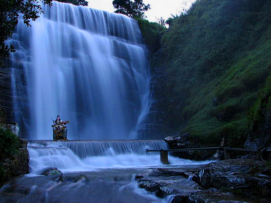
Dunsinane Falls drops around 100 metres down the Pundalu Oya in the tea country near Pundaluoya, between the Dunsinane and Sheen estates, and the name is Scottish — Dunsinane Hill of Macbeth — the estate having been opened for coffee by the 1840s and credited to George Smyttan Duff, a planter born in Dunkeld, in the same Perthshire country as Birnam Wood.
You see the upper curtain of Dunsinane Falls from the road bridge, with the rest of the drop hidden in the gorge below, and the estate around it is still working tea — some 490 hectares of it, with a factory from 1920 at about 1,400 metres.
The estates around Dunsinane were worked by Tamil labourers recruited from South India from the 1820s, and in 1948 Ceylon’s new Citizenship Act left most of their descendants stateless, around 700,000 people — many were later sent to India under agreements in 1964 and 1974, and the last were only granted citizenship in 2003.
7 – Horton Plains & Baker’s Falls
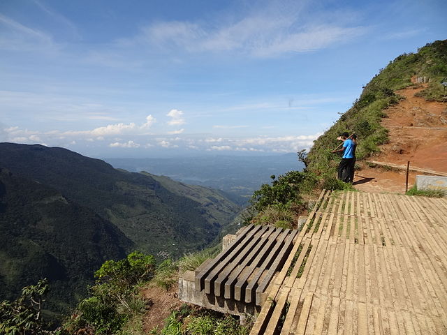
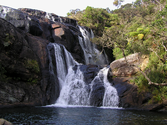
Horton Plains is a high plateau of grassland and cloud forest at 2,100 to 2,300 metres in the south of Sri Lanka’s hill country, named after the British governor Sir Robert Wilmot-Horton, a national park since 1988 and, with Sri Pada and the Knuckles, part of the Central Highlands World Heritage Site.
The loop walk across Horton Plains takes in Baker’s Falls, a 20-metre step named after the explorer Samuel Baker, and ends at World’s End, where the plateau stops at a sheer cliff of roughly 870 metres — get there before about ten in the morning, because the mist rolls in and the view vanishes; plastic bags aren’t allowed in the park.
The open grass of Horton Plains is often called man-made, the result of centuries of burning, but the story is older and more mixed: pollen cores show grassland here naturally at the height of the last ice age, and people already burning and clearing the plateau roughly 13,000 years ago.
8 – Minneriya National Park
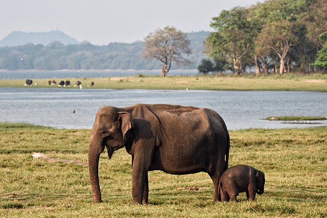
Minneriya National Park lies in the dry zone of north-central Sri Lanka around the Minneriya tank, a reservoir built by King Mahasena in the 3rd century AD, with a dam two kilometres long that still waters the fields around it.
Minneriya is known for the Gathering: as the tank drains in the dry season, roughly August to October, the exposed grass on its bed draws elephants in from the surrounding forest, peaking in the hundreds in good years — widely described as one of the great wildlife spectacles in Asia — before the herds move on to nearby Kaudulla.
The Gathering at Minneriya has been failing since around 2018, because water released from the new Moragahakanda reservoir now keeps the ancient tank too full to expose its grass — in 2021 the September peak fell below two hundred elephants, and in 2022 the Gathering barely happened at all.
9 – Kuttam Pokuna
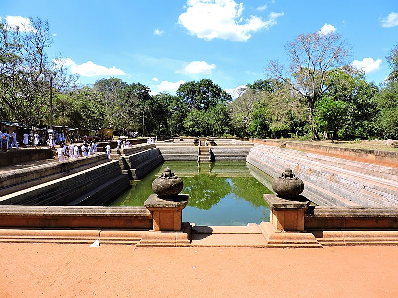
Kuttam Pokuna, the Twin Ponds, lie within the Abhayagiri monastery in Anuradhapura, the capital of Sri Lanka for some 1,300 years until an invasion from South India in 993, and they were built as bathing pools for the monks, probably in the 8th or 9th century.
The northern of the Kuttam Pokuna is about 28 metres long and the southern about 40, both stepped and faced in cut stone, fed through underground ducts and settling chambers that filtered the water before it poured in through a carved spout — watched over by a five-headed cobra carved beside the northern pond.
The Kuttam Pokuna are one small part of Anuradhapura, and the city’s great survivor is the Jaya Sri Maha Bodhi, a fig grown by tradition from a cutting of the tree under which the Buddha found enlightenment, brought by Ashoka’s daughter — Guinness dates it to 288 BC and calls it the oldest tree known to have been planted by a person.
10 – Ancient City of Polonnaruwa
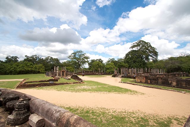
Polonnaruwa, in the dry zone of north-central Sri Lanka, became the island’s capital after Anuradhapura fell to the Cholas at the end of the 10th century, and it had its golden age under King Parakramabahu I, who ruled from 1153 to 1186.
The ruins of Polonnaruwa spread for kilometres — the Vatadage’s circular relic house, the brick shell of the Lankatilaka, and the Gal Vihara, four Buddhas cut from one granite face, including a reclining figure 14 metres long — and by the water stands a stone figure always called Parakramabahu, though whether it shows the king or a sage is still argued.
The great reservoir at Polonnaruwa is called the Parakrama Samudra, the Sea of Parakrama, and the Culavamsa credits it to him, but it is several older tanks joined together — its northernmost part, Topa Wewa, is dated to around 386 AD, some seven and a half centuries before he was born.
11 – Gangaramaya Buddhist Temple
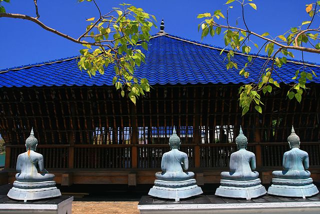
Gangaramaya is a Buddhist temple in the middle of Colombo, near Beira Lake, founded in 1885 by the scholar-monk Hikkaduwe Sri Sumangala, and it grew into one of the city’s busiest temples and a centre of Buddhist learning.
Gangaramaya is a crowded, eclectic place — shrine rooms, a bodhi tree, and a museum crammed with gifts from devotees, from Buddha images to a stuffed elephant — and each February, around the Navam full moon, it stages one of Colombo’s biggest processions, the Navam Perahera, held since 1979.
The temple’s most photographed building, the Seema Malaka on its platforms in Beira Lake, belongs to Gangaramaya but was redesigned in the late 1970s by Sri Lanka’s most celebrated architect, Geoffrey Bawa, after the old one sank — and the rebuilding was paid for by a Muslim businessman, S. H. Moosajee, and his wife, in memory of their son.
12 – Knuckles Mountain Range
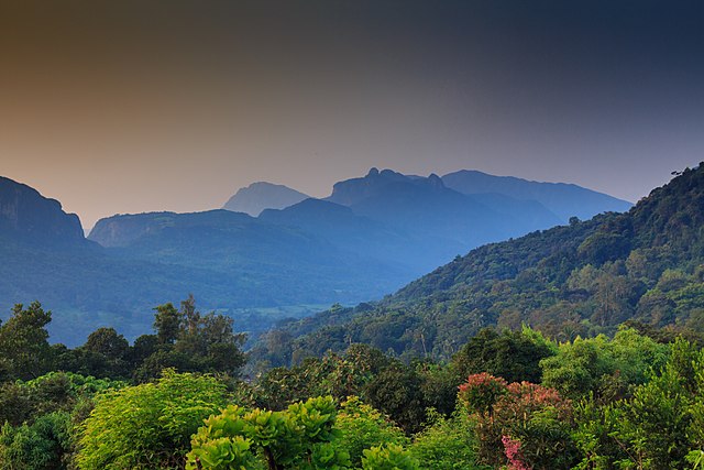
The Knuckles Mountain Range rises north-east of Kandy to 1,906 metres at Gombaniya, and it got its English name from British surveyors who thought its row of peaks looked like the knuckles of a clenched fist — in Sinhala it is Dumbara Kanduvetiya, the mist-laden mountains.
The Knuckles is walking country, with no big sights, just trails through cloud forest, grassland, tea and small villages, rivers and waterfalls; it forms part of the Central Highlands World Heritage Site along with Sri Pada and Horton Plains, and it’s best done with a local guide.
The Knuckles is packed with life found nowhere else: a UN survey counted 160 endemic plants among its 1,033 flowering species, 17 endemic fish out of 35, and 25 endemic amphibians — though the Blue Mormon butterfly it is often said to be home to exclusively also lives in southern India.
13 – St Clair’s Falls
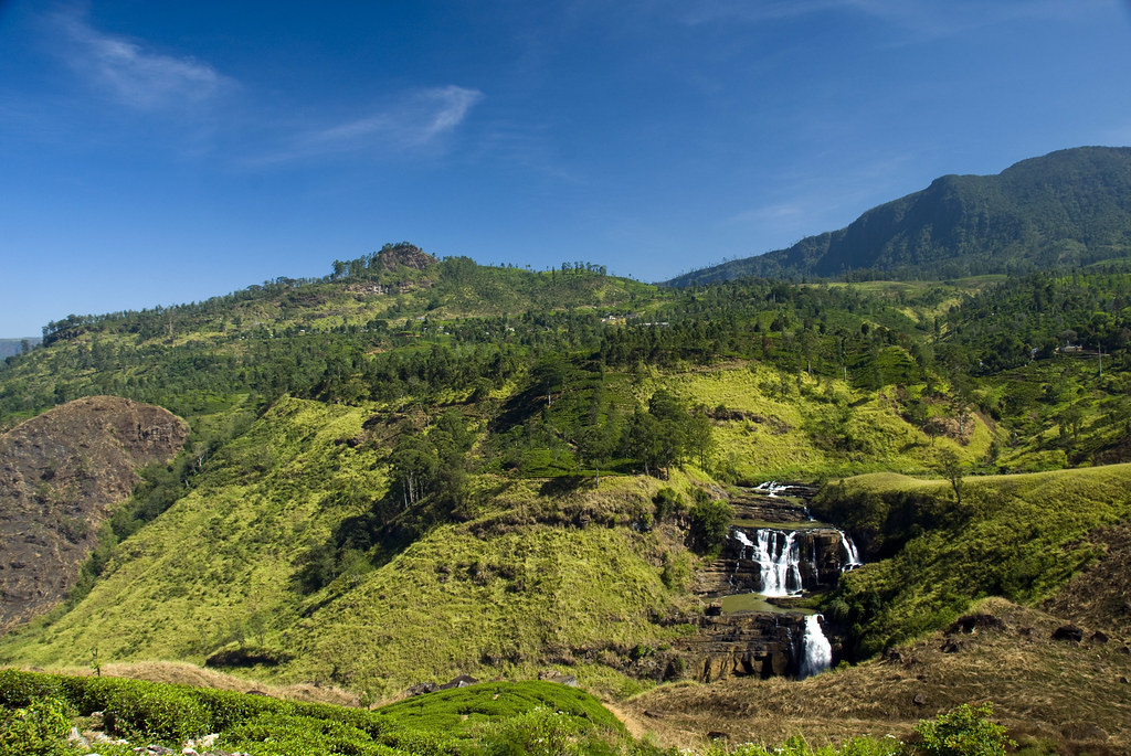
St Clair’s Falls pours down the Kotmale Oya near Talawakele in the heart of tea country, named after the St Clair tea estate it runs through, and it is really two falls — the Maha Ella, about 80 metres high and 50 wide, and the smaller Kuda Ella.
St Clair’s Falls is seen from viewpoints on the road between Hatton and Nuwara Eliya, with Devon Falls a few minutes further on, and it’s often called Sri Lanka’s widest waterfall — “the Little Niagara” — though nobody seems to have measured the others to check.
Since 2012 St Clair’s Falls has run on a timetable: the Upper Kotmale hydropower dam, 2.2 kilometres upstream, sends the river through a 13-kilometre tunnel, and the Ceylon Electricity Board releases about 1.3 cubic metres a second over the falls from 5am to 3pm — roughly a tenth of the old average flow — so come early, and come after heavy rain, when the spill gates open.
14 – Yala National Park
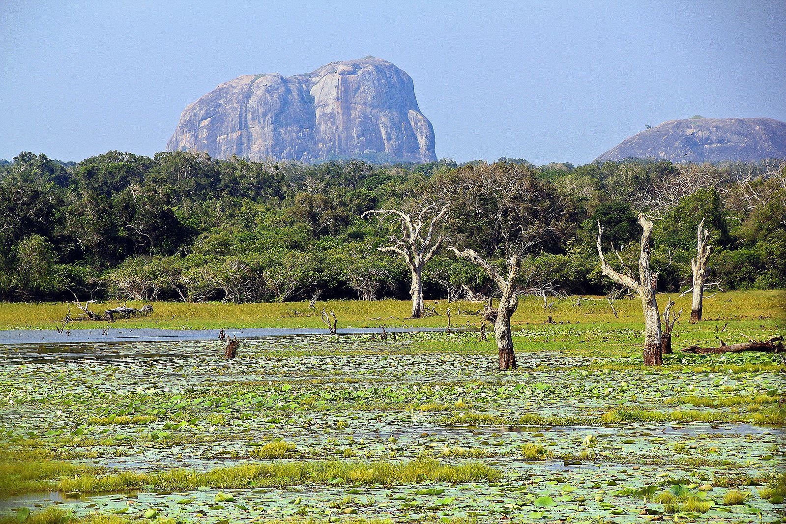
Yala National Park covers almost a thousand square kilometres of scrub, lagoons and rock outcrops on Sri Lanka’s south-east coast — the country’s second-largest park after Wilpattu, and protected in part since 1900 — and it holds the ruins of an old farming landscape, including the Sithulpawwa rock monastery, founded in the 2nd century BC.
Most visitors to Yala go by jeep into Block I, looking for elephants, sloth bears, crocodiles, peacocks and, above all, leopards; on the shore at Patanangala a memorial records the 47 people killed in the park by the 2004 tsunami.
Yala is routinely said to have the highest density of leopards in the world, which it doesn’t — studies put Block I at around 12 adults per 100 square kilometres, against about 30 in parts of South Africa’s Kruger — but it is one of the highest anywhere, and the leopards here, with no lions or tigers to fear, hunt in daylight in the open.
15 – Galle Fort
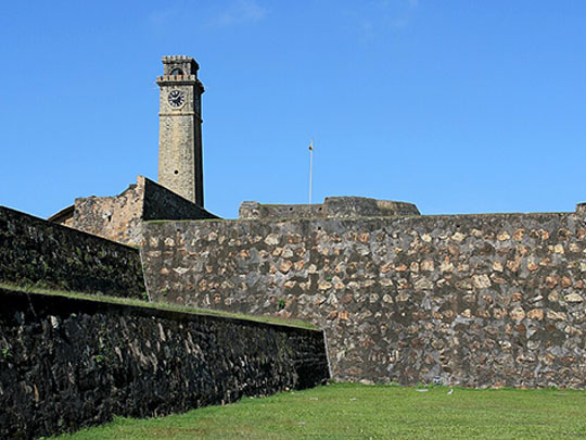

Galle Fort covers a small headland on Sri Lanka’s south-west coast, founded by the Portuguese in the 16th century and taken by the Dutch after a siege in 1640, who built most of the walls in 1663; Galle was the island’s main port until the British built up Colombo’s harbour in the 19th century, and UNESCO listed it in 1988.
The thing to do in Galle Fort is walk the ramparts, about two kilometres of them with fourteen bastions, past the 1939 lighthouse on the Utrecht Bastion and the Old Gate, where the Dutch East India Company’s monogram is dated 1669 — and inside the walls it’s a living town, streets of Dutch houses, shops and cafés around the Groote Kerk of 1755.
On 26 December 2004 the tsunami broke on Galle, and the Dutch ramparts did what they were built for: UNESCO found the old town inside suffered only relatively minor damage, mostly flooding through the gates, while outside the walls, around the bus station and the new town, at least two hundred people died.
16 – Jaffna
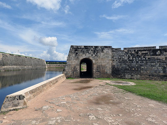
Jaffna is the city at the top of the Jaffna peninsula in Sri Lanka’s far north, capital of a Tamil kingdom until the Portuguese took it in 1619, then Dutch, then British — the centre of Tamil life on the island, and a frontline of the civil war that ran from 1983 to 2009.
In Jaffna the pentagonal fort the Portuguese began and the Dutch rebuilt around 1680 still stands by the lagoon, and Nallur Kandaswamy Kovil, the great Hindu temple of the north, rebuilt in 1734 after the Portuguese destroyed its predecessor, draws huge crowds for its 25-day festival each summer — men take their shirts off to go in.
On the night of 31 May 1981 the Jaffna Public Library, then one of the largest in Asia, was burned with some 95,000 to 97,000 books and manuscripts — a civil-society inquiry, the Movement for Inter-Racial Justice and Equality, attributed it to a group of police — and the rebuilt library reopened in 2003, with a prime minister’s apology in parliament following in 2016.
17 – Sinharaja Forest Reserve
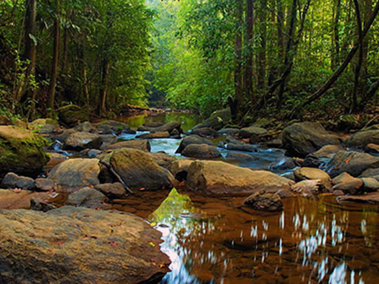

Sinharaja Forest Reserve covers about 8,860 hectares of hills in south-west Sri Lanka, between 300 and 1,170 metres, and UNESCO calls it the island’s last viable area of primary tropical rainforest — protected on paper since 1875, selectively logged in the 1970s, and listed as a World Heritage Site in 1988.
You walk Sinharaja with a licensed guide, which is compulsory, on trails under a high, dripping canopy — more than 60% of the trees here are found only in Sri Lanka — watching for the Sri Lanka blue magpie, the red-faced malkoha and the mixed flocks of birds that move through the forest together, and yes, there are leeches.
Sinharaja’s World Heritage citation says it holds 19 of Sri Lanka’s 20 endemic birds, which was true in the 1980s and isn’t now — taxonomists have since split so many species that the island counts around 35 endemics, most of which you can still find here, and the forest keeps turning up new frogs, lizards and plants.