
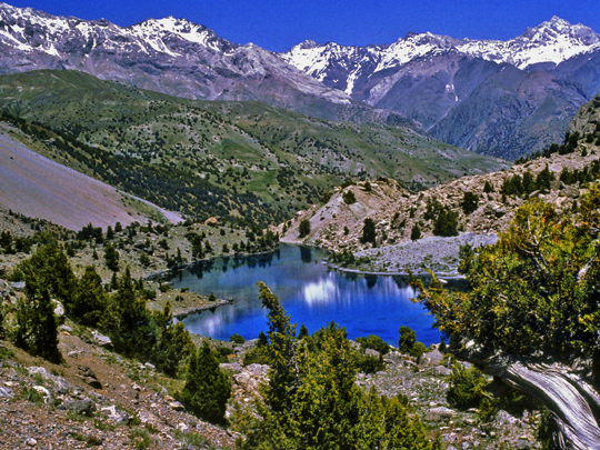
Wikimedia Commons / CC-BY-SA-3.0 / GFDL
Capital: Dushanbe
Population: 10.7 million+
Language: Tajik
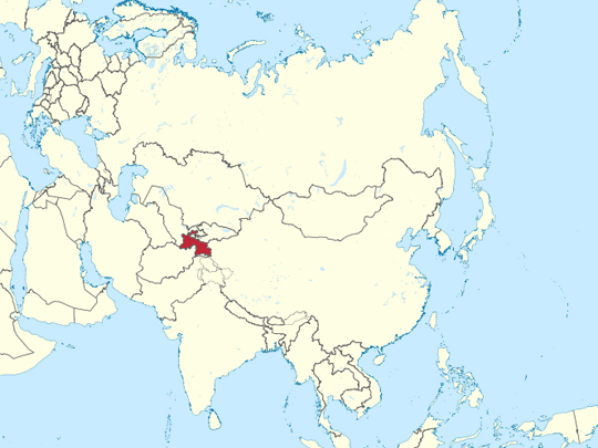
1 – Fann Mountains (also above)
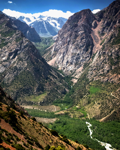
The Fann Mountains rise in Sughd province in north-west Tajikistan, a tight knot of peaks between the Zeravshan and Hissar ranges topped by Chimtarga at 5,489 metres, and they sit on the edge of what was Sogdiana — the Iranian-speaking world whose merchants ran the middle stretch of the Silk Road.
The Fann Mountains are trekking country from late June to mid-September: the glacial Kulikalon and Alauddin lakes at about 2,800 metres under Chimtarga, the Seven Lakes of the Shing valley, a chain dammed by old rockfalls and each a different green, and Iskanderkul on the northern edge.
In the Yaghnob valley on the eastern flank of the Fann Mountains people still speak Yaghnobi, descended from a dialect of Sogdian, the Silk Road merchants’ language, which otherwise died out a thousand years ago — and the Soviet state emptied the valley twice, in 1970 and again in 1978, moving its people to the cotton farms; a few hundred have since come back.
2 – Ayni Opera – Dushanbe
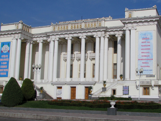
The Ayni Opera and Ballet Theatre is the grandest Soviet building in Dushanbe — a name that means Monday in Persian, after the town’s old Monday market — begun in 1938 when the city was called Stalinabad, and named from 1954 after Sadriddin Ayni, the writer counted as the founder of modern Tajik literature.
The Ayni Opera is a colonnaded, fountain-fronted palace of the arts with a chandeliered hall inside, home to the company that staged the first Tajik opera in 1939, and it reopened on Navruz in 2009 after a five-year restoration, with a new production of the opera Rudaki.
The Ayni Opera wasn’t designed for Dushanbe at all: according to the Tajik news agency Asia-Plus, the plans won a 1929 competition for a theatre in Samarkand, then the capital of Soviet Uzbekistan, and Tajikistan bought the drawings in 1931 — so the national theatre of Tajikistan is a building meant for its neighbour.
3 – Usoi Dam & Sarez Lake
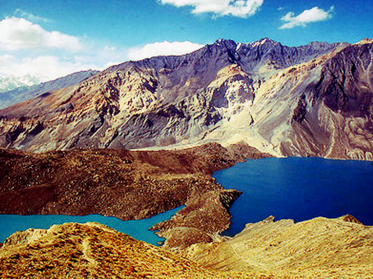
Sarez Lake lies at about 3,260 metres in the Pamirs of Gorno-Badakhshan, made in a night on 18 February 1911, when an earthquake brought down some two cubic kilometres of mountainside, buried the village of Usoi and blocked the Murghab river — the Usoi Dam it left is more than 500 metres high, the tallest dam on earth, natural or man-made.
Behind the Usoi Dam, Sarez Lake has filled to some 60 kilometres long and 500 metres deep, and reaching it takes a long drive and a hike plus a special permit on top of the Gorno-Badakhshan one; it has had an early-warning system since 2004 and satellite monitoring since 2021.
Sarez is routinely called Central Asia’s most dangerous lake, with five million people downstream said to be at risk if the dam bursts, but a 2004 World Bank study found the dam stable and a US Geological Survey model put those affected by a moderate outburst at 35,000 or more — the real fear is a landslide on the right bank sending a wave over it.
4 – Pamir Highway & Mountains
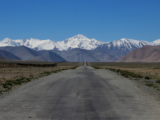
The Pamir Highway, the M41, runs some 1,250 kilometres from Dushanbe through Khorog to Osh in Kyrgyzstan, its Osh–Khorog section built by the Soviets in the early 1930s to supply the border posts, across the Pamirs — the mountains the Persian phrase Bam-i-Dunya, the Roof of the World, described.
The Pamir Highway follows the Panj river with Afghanistan across the water, climbs to the high plateau at Murghab, passes Karakul, a lake at almost 4,000 metres inside a 52-kilometre meteorite crater, and tops out at the Ak-Baital pass at 4,655 metres; the region’s Pamiri people are mostly Ismaili Muslims, and you need a Gorno-Badakhshan permit, bought with the e-visa.
The Pamir Highway is often billed as the second-highest international road in the world, which it isn’t — the Karakoram Highway and the China–Nepal Friendship Highway both go higher — but the country it crosses is bigger than people expect: Tajik National Park, listed by UNESCO in 2013, covers about 18% of Tajikistan.
5 – Khujand
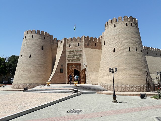
Khujand stands on the Syr Darya at the western mouth of the Fergana valley, Tajikistan’s second city, and it is generally identified with Alexandria Eschate — Alexandria the Furthest — founded by Alexander in 329 BC, though archaeologists have found little more of it than a few Hellenistic sherds; the Soviets called it Leninabad.
Khujand’s fortress is a restored stretch of mud-brick wall and gate by the river, with the Sughd historical museum inside, opened in 1986 for the city’s 2,500th anniversary, and across town is the Panjshanbe, or Thursday, bazaar; the giant Lenin that stood here, the biggest in Central Asia, was moved to a park in 2011 to make way for the 10th-century ruler Ismoil Somoni.
When the Mongols came in 1220, Khujand’s governor Timur Malik held out on a fortified island in the Syr Darya, and when it could hold no longer he broke out downriver by boat at night — one of the very few commanders to escape a siege by Genghis Khan’s armies, and a hero in Tajikistan ever since.
6 – Iskanderkul
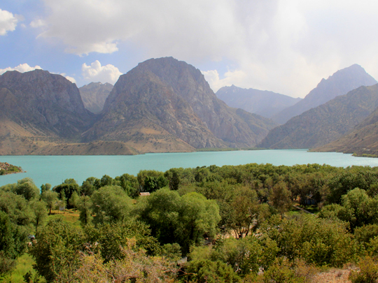
Iskanderkul, Alexander’s Lake, lies at 2,195 metres on the northern edge of the Fann Mountains, a mountain lake of about 3.4 square kilometres and up to 72 metres deep, dammed by an ancient landslide and named after the Macedonian king who campaigned in Sogdiana between 329 and 327 BC.
Iskanderkul is an easy trip from Dushanbe, with homestays and a guesthouse by the water, walks on the shore, a waterfall of about 43 metres a short way down its outflow, and a presidential dacha on the shore.
The story told at Iskanderkul is that Alexander’s horse Bucephalus drowned here, and that a white horse still rises from the water on moonlit nights — but Bucephalus died in 326 BC beside the Hydaspes river in the Punjab, after Alexander had left Central Asia behind, and the king named a city there after him.
7 – Penjikent
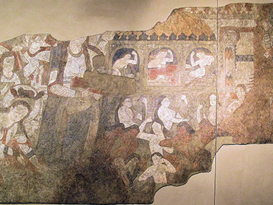
Penjikent lies in the Zeravshan valley in north-west Tajikistan, just across the border from Samarkand, and on the terrace above the modern town are the ruins of a Sogdian merchant city founded in the 5th century — taken by the Arabs in 722, when its ruler Devashtich was captured and executed, and now part of a Silk Roads World Heritage Site listed in 2023.
At Penjikent you walk about 12 hectares of excavated mud-brick streets, houses, two temples and a citadel, while the finest wall paintings, including a whole hall of the Persian hero Rustam’s battles painted around 740, are in the Hermitage in St Petersburg and in Dushanbe.
What makes Penjikent special is that ordinary merchants’ houses, not just temples and palaces, were painted, which is why it’s called the Pompeii of Central Asia — though its people weren’t wiped out, they moved away around 770 — and Boris Marshak, who led the excavations for 28 years, died on the site in 2006 and is buried there, as he asked.
8 – Nurek & Rogun Dams
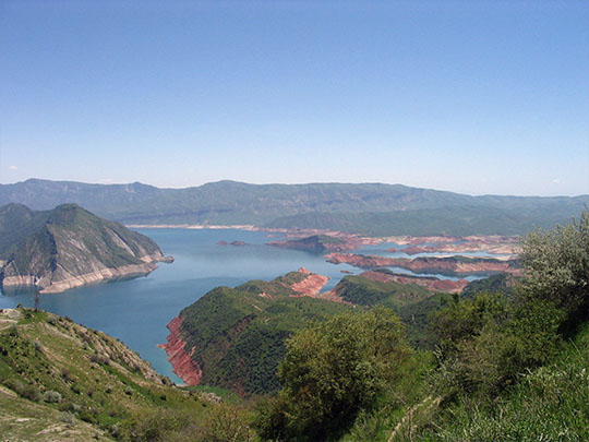

The Nurek and Rogun dams stand on the Vakhsh river in the mountains east of Dushanbe, and Nurek, a 300-metre wall of rock and earth built between 1961 and 1980, was the tallest dam in the world until 2013 and still supplies about 70% of Tajikistan’s electricity.
Rogun, upstream of Nurek, was begun by the Soviets in 1976, had much of its early work washed out by a flood in 1993, and was restarted in 2016, with its first turbine running in 2018 — it is planned at 335 metres, which would make it the tallest dam ever built, and is due to be finished around 2029.
Rogun’s reservoir will flood the upper Vakhsh valley, and the World Bank counts some 46,600 people from 69 villages to be resettled, campaigners up to 60,000; Uzbekistan, downstream, fought the dam for years over water for its cotton before softening in 2018 — and in the Pamirs, the Usoi Dam, which nature built in a night in 1911, is taller than either.