
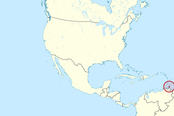
Wikimedia Commons / CC-BY-SA-3.0 / GFDL
Capital: Port of Spain
Population: 1.4 million+
Language: English/Trinidadian and Tobagonian Creole
1 – Store Bay (also above)
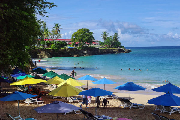
A short golden beach at Tobago’s south-west tip, a few minutes’ walk from the airport, and for most visitors the first place they set foot on the island.
Behind the sand is a row of food stalls run by the same families for generations, serving Tobago’s defining dish — blue crab slow-cooked in spiced curry gravy with hand-rolled dumplings — and glass-bottom boats leave from here for Buccoo Reef.
Those boats stop at the Nylon Pool, a waist-deep sandbar in the open sea a mile offshore, named by Princess Margaret on a visit in 1962 because the water was as clear as her stockings.
2 – Port of Spain

Trinidad’s capital sits on the Gulf of Paria under a wall of green hills, a Spanish town taken by the British in 1797 and rebuilt after a fire in 1808, when the governor laid out the Queen’s Park Savannah that still anchors the city.
Walk the Savannah past the Magnificent Seven, a row of extravagant colonial mansions, then down to Woodford Square and the Red House parliament building; at Carnival the whole city turns into the street.
The steelpan was invented in the hills of Laventille just above town: the British had banned African drumming, then banned the bamboo instruments that replaced it, so from the 1930s people beat tunes out of scrap metal and discarded oil drums instead — it’s widely called the only acoustic instrument invented in the 20th century.
3 – Chatham Beach
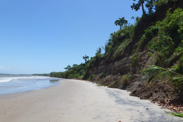
A long grey-sand beach on Trinidad’s remote south-western peninsula, facing the Columbus Channel with Venezuela on the horizon about ten miles away.
Fishing boats pull up on the sand, there’s almost nothing built along it, and the sunsets are the reason Trinidadians drive two hours to get here.
This corner of Trinidad is the closest the Caribbean comes to South America, and the island’s flora, fauna and geology are continental rather than oceanic — which is why Trinidad has ocelots, howler monkeys and 400-odd bird species, and its neighbours don’t.
4 – Scarborough
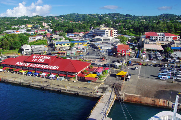
Tobago’s capital climbs a hillside above Rockly Bay on the south coast, and it has changed hands more often than almost anywhere in the Caribbean — the island passed between the Dutch, French, British and others repeatedly before Britain finally kept it in 1814.
The town is a working port with a market, and above it stands Fort King George, built by the British in the 1770s, with its powder magazine, cannon and a museum in the old barracks.
From the fort’s walls you look straight down on the harbour — which is exactly the point, since the guns were there to hold an island that had been taken and retaken so many times nobody could quite agree on the count.
5 – Parlatuvier Bay
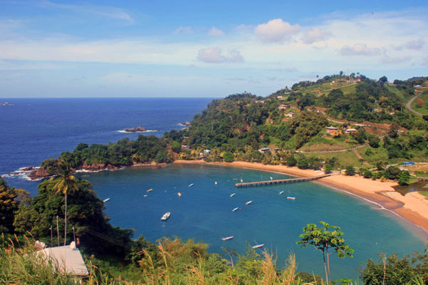
A fishing village on Tobago’s north coast, wrapped around a deep horseshoe bay with a wooden jetty running into it, on the road that skirts the Main Ridge.
The view from the road above is one of the best on the island; down at the water there are pirogues, a small beach and not much else.
The forest behind it is the Main Ridge Forest Reserve, protected by an ordinance of April 1776 “for the purpose of attracting frequent showers of rain” — the oldest legally protected forest reserve in the western hemisphere, and one writer has called it the first act of the modern environmental movement.
6 – Five Islands Causeway

A cluster of small islands in the Gulf of Paria, just west of Port of Spain, linked by causeways and once the arrival point for hundreds of thousands of indentured labourers brought from India and China.
Boats run out from Chaguaramas to the restored buildings on Nelson Island, and the others hold ruins, a wartime gun emplacement and a great deal of birdlife.
Nelson Island has been called the Ellis Island of Trinidad and Tobago: new arrivals were inspected, fumigated and quarantined here before being sent to the estates, and the same buildings were later used to detain political prisoners, including the labour leader Uriah Butler.
7 – Mayaro Beach

A vast open beach running for miles down Trinidad’s east coast, backed by coconut estates and facing the Atlantic — the island’s longest stretch of sand and its traditional holiday coast.
Trinidadians rent beach houses here for Easter and Carnival weekends; the surf is rough, the sand is brown, and the coconut palms run behind it almost the whole way.
Look out to sea and you’ll spot platforms on the horizon: the water off this coast is Trinidad’s oil and gas field, which is why the country is the most industrialised in the Caribbean and why its beaches were never turned into resorts.