
Wikimedia Commons / CC-BY-SA-3.0 / GFDL
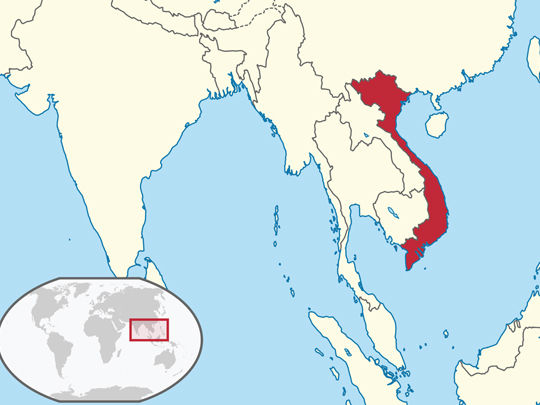
Capital: Hanoi
Population: 101.3 million+
Language: Vietnamese (written in quốc ngữ).
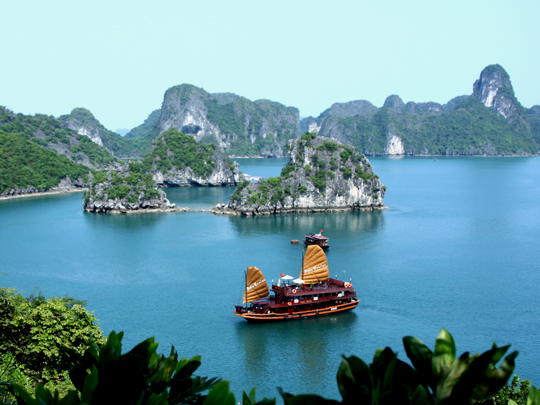
1 – Halong Bay (also above)
Ha Long Bay, in the Gulf of Tonkin in north-east Vietnam, is a drowned limestone landscape of pillars and islands whose name means “descending dragon,” after the legend of a dragon that came down to defend the coast; UNESCO listed it in 1994 and extended it in 2023 to take in the Cat Ba archipelago.
Ha Long Bay is seen by boat, on day trips and overnight cruises through the karsts to caves like Sung Sot, past the old floating fishing villages whose families were moved ashore in 2014 — and in July 2025 a sightseeing boat, the Wonder Sea, capsized in a sudden storm here and 39 people died.
On the Bạch Đằng river at the western edge of Ha Long Bay, Vietnamese commanders twice set wooden stakes in the riverbed and lured invading fleets onto them as the tide fell — in 938 against the Southern Han, and in 1288 against Kublai Khan’s Mongols — and archaeologists have since dug up the stakes.
2 – Nha Trang
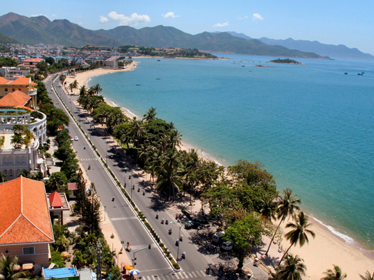
Nha Trang is the beach city of Vietnam’s south-central coast, and above the Cái river stand the Po Nagar towers, built by the Champa kingdom between the 8th and 13th centuries for a goddess who is still worshipped there today, by Vietnamese and Cham alike.
Nha Trang is beaches, boat trips to the islands of the bay and diving around Hòn Mun, Vietnam’s first marine protected area, set up in 2001, though its coral has declined so badly that diving there has been suspended since 2022.
Nha Trang was home to Alexandre Yersin, the Swiss-French doctor who identified the bacterium that causes plague in Hong Kong in 1894, then settled here, set up a laboratory and is buried at Suối Dầu outside the city — one of the few Frenchmen whose name Vietnam kept on its streets after 1975.
3 – Củ Chi
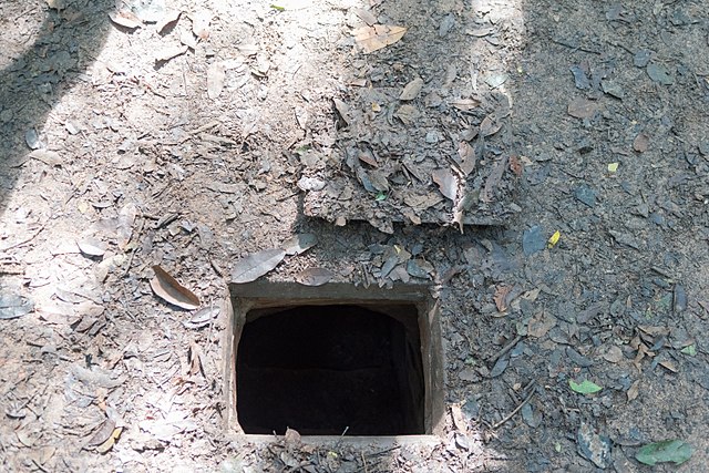
The Củ Chi tunnels lie in the countryside north-west of Ho Chi Minh City, a network begun around 1948 against the French and extended in the 1960s into something like 120 to over 200 kilometres of passages on two or three levels, used by Viet Cong fighters as bases, hospitals and supply routes.
At Củ Chi you can crawl through short sections of tunnel — widened for visitors — at Bến Dược, the old command headquarters, or Bến Đình, which is mostly reconstructed, see trapdoors, kitchens with smoke vents and booby traps, and fire old weapons at a shooting range on the site.
Củ Chi was the target of some of the war’s biggest operations: Operation Crimp in January 1966 sent about 8,000 American and Australian troops into the area, Operation Cedar Falls in 1967 about 30,000, and from 1969 B-52s carpet-bombed it — and the US Army trained volunteers known as “tunnel rats” to go down after the fighters.
4 – Imperial City – Huế

The Imperial City of Huế, in central Vietnam on the Perfume River, was the seat of the Nguyễn dynasty from 1802 until 1945, a walled citadel begun in 1804 with French-style bastions around a palace laid out like Beijing’s Forbidden City; UNESCO listed it in 1993.
Inside Huế’s walls you walk through the Meridian Gate, past the Thái Hòa throne hall, and into the Purple Forbidden City, the emperors’ private quarter, where Bảo Đại, the last emperor, abdicated in August 1945 — much of it now open ground where palaces once stood.
Huế’s lost buildings are usually blamed on the battle of 1968, which did terrible damage — but several, including the Kiến Trung and Cần Chánh palaces, had already been destroyed in the fighting of 1945–47, and both are now being rebuilt, Kiến Trung reopened in 2024.
5 – Sapa
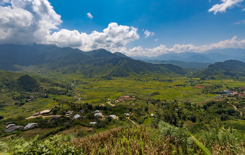
Sapa sits at about 1,500 metres in the mountains of far northern Vietnam near the Chinese border, a hill station the French built up in the early 20th century to escape the heat of the lowlands, and the market town for the Hmong and Dao villages around it.
From Sapa you trek through the rice terraces of the Mường Hoa valley to Hmong and Dao villages, or take the cable car to the top of Fansipan, opened in 2016 and holding two Guinness records — the longest non-stop three-rope cable car and the greatest elevation difference.
Fansipan, above Sapa, is the highest mountain in what was French Indochina, and it got taller in 2019, when a satellite survey measured it at 3,147.3 metres, about four metres more than the French figure of 1909.
6 – Mỹ Sơn
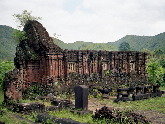
Mỹ Sơn lies in a jungle valley inland from Hội An in central Vietnam, the holy sanctuary of the Champa kingdom, where temples to the Hindu god Shiva were built in brick from the 4th to the 13th century; the French recorded about seventy of them from 1898, and UNESCO listed it in 1999.
At Mỹ Sơn you walk between groups of red-brick towers carved with gods, dancers and lions, many reduced to stumps, and the bricks are fitted so tightly, with almost no visible mortar, that exactly how the Cham builders did it is still not fully understood.
Mỹ Sơn was badly damaged in the wars of the 20th century, above all by bombing during the American war, and much of the work of saving it was done by a Polish architect, Kazimierz Kwiatkowski, who spent some sixteen years here from 1981 and has a memorial at the site — and since 2017 India’s archaeological service has been restoring further temple groups.
7 – Bản Giốc–Detian
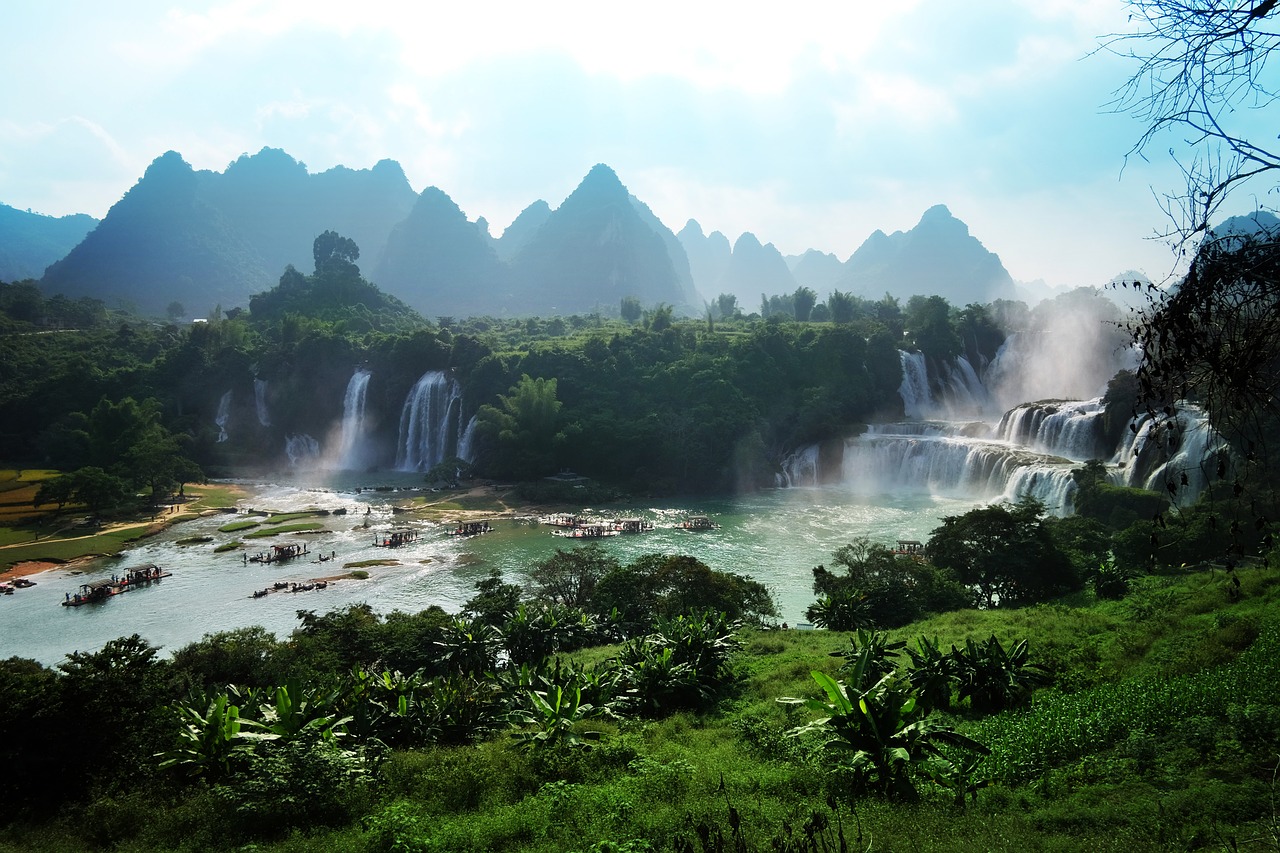

Bản Giốc–Detian Falls drops about 30 metres across a broad step of limestone on the Quây Sơn river, which forms the border between Vietnam and China in Cao Bằng province, and the line through the falls was settled only by the land border treaty of 1999.
Bản Giốc is seen from the Vietnamese bank or from rafts that go up close to the spray, at its fullest after the summer rains, and it’s a long drive from Hanoi through the karst country of Cao Bằng, one of the quietest corners of the country.
Bản Giốc–Detian has been one shared scenic area since 2024, when Vietnam and China opened a cooperation zone where visitors can cross to the other side for a few hours — but only Vietnamese and Chinese citizens can, so everyone else still looks at China from the bank.
8 – Hội An

Hội An lies at the mouth of the Thu Bồn river on Vietnam’s central coast, about 40 kilometres from Mỹ Sơn, and from the 15th to the 19th century it was one of the great trading ports of South-East Asia, where Japanese, Chinese and European merchants settled; UNESCO listed it in 1999.
Hội An’s old town is more than a thousand timber shophouses, assembly halls and temples, best walked in the evening when the silk lanterns are lit, and its emblem is the covered Japanese Bridge, with a small temple built onto it, traditionally dated to the 1590s and on the 20,000-dong note.
Hội An survived because it was left behind: in the 19th century trade moved up the coast to Da Nang, the town stagnated, and nobody had the money or the reason to tear down its wooden buildings — though the river that made it now floods its streets most autumns.
9 – Phong Nha & Sơn Đoòng
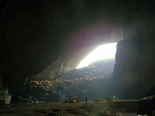
Phong Nha–Kẻ Bàng National Park, in the limestone mountains of north-central Vietnam near the Lao border, holds one of the oldest and most extensive karst landscapes in Asia, threaded with hundreds of caves; UNESCO listed it in 2003, and since 2025 it has been a single World Heritage Site with Laos’s Hin Nam No.
Phong Nha’s easier caves — Phong Nha itself, reached by boat along an underground river, and the white formations of Paradise Cave — are open to everyone, but Sơn Đoòng, the largest cave passage in the world, more than five kilometres long and up to 200 metres high, can only be reached on a multi-day expedition, for around $3,000, from January to August.
Sơn Đoòng was found in 1990 by a local man, Hồ Khanh, while he was searching the forest for agarwood — but he lost the entrance, only found it again in 2008, and the following year led British cavers into a passage with its own jungle, growing where the roof has fallen in.
10 – Hanoi
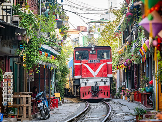
Hanoi has been Vietnam’s capital, on and off, since 1010, when the emperor Lý Thái Tổ moved his court here and called it Thăng Long, “ascending dragon” — the mirror of Ha Long’s descending one — and the excavated heart of that old citadel became a World Heritage Site in 2010.
In Hanoi you can walk the lanes of the Old Quarter, circle Hoàn Kiếm lake, queue for Hồ Chí Minh’s mausoleum, and visit the Temple of Literature, founded in 1070, where 82 stone stelae carried on the backs of stone turtles record 1,307 men who passed the imperial doctoral exams between 1442 and 1779.
Hanoi’s Hỏa Lò prison was built by the French between 1896 and 1901 for Vietnamese political prisoners, and later held American pilots, who called it the “Hanoi Hilton” — most of it was knocked down in the 1990s for an office and hotel tower, and only the gatehouse survives, as a museum.