
Wikimedia Commons / CC-BY-SA-3.0 / GFDL
Capital: Washington D.C.
Population: 342 million+ (more than 31 million Americans report Irish ancestry).
Language: English
Click here to browse state by state.
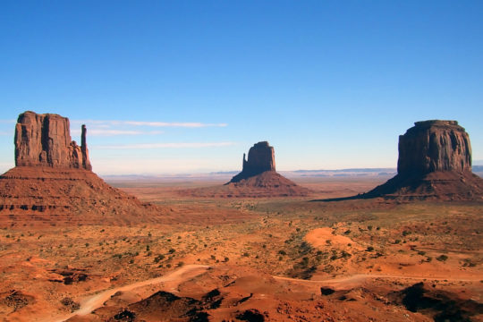
1 – Monument Valley – Utah (above)
(Click here to see more of this state)
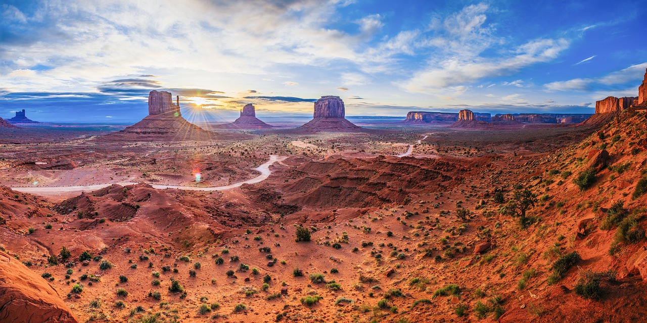
Straddling the Utah–Arizona border on Navajo Nation land, Monument Valley — Tsé Biiʼ Ndzisgaii — has been run since 1958 by the Navajo as a tribal park, not by the National Park Service, and its sandstone buttes rise as much as 300 metres above the valley floor.
Monument Valley’s 17-mile loop drive passes the Mittens and Merrick Butte, which are in fact on the Arizona side, to John Ford Point, and on US 163 just north, in Utah, is the spot where Forrest Gump stops running in the 1994 film.
The trader Harry Goulding is credited with bringing Monument Valley to John Ford’s attention with a set of photographs, and Ford shot Stagecoach here in 1939, then came back for My Darling Clementine, Fort Apache, She Wore a Yellow Ribbon and The Searchers.
2 – Yosemite National Park – California

(Click here to see more of this state)
In California’s Sierra Nevada, Yosemite became the first scenic land the federal government set aside for public use when Lincoln signed the Yosemite Grant on 30 June 1864, handing it to the state, and it became a national park in 1890.
Yosemite Valley is ringed by Half Dome, Yosemite Falls, at 739 metres one of the tallest in North America, and El Capitan, which Alex Honnold climbed without ropes in June 2017, and for a few days each February the sunset lights Horsetail Fall on El Capitan like a stream of fire.
“Yosemite” doesn’t mean “grizzly bear”, as was long claimed — it comes from the Miwok for “they are killers”, their name for the valley’s people — and the Irishman James McCauley started the original Firefall in the 1870s by kicking campfire embers off Glacier Point, a show the park ended in 1968.
3 – Denali National Park – Alaska
(Click here to see more of this state)
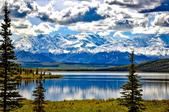
In the Alaska Range, Denali — “the high one” in Koyukon — is North America’s highest peak at 6,190 metres, rising some 5,500 metres from its base, more than Everest does from its plateau, and on 7 June 1913 Walter Harper, of Koyukon descent, was first to its summit.
Denali National Park’s single 92-mile road was cut by a landslide at Pretty Rocks in 2021, and a new bridge finished in September 2026 should reopen it to buses in 2027, while the park keeps the only sled-dog kennels in the National Park Service, working since 1922.
The mountain’s names lead back to County Antrim: William McKinley, for whom a prospector named it in 1896, came of a family from near Dervock, and Harper’s father Arthur is recorded as Antrim-born — and since January 2025 the US government again calls the peak Mount McKinley, though the park is still Denali.
4 – Grand Canyon – Arizona
(Click here to see more of this state)
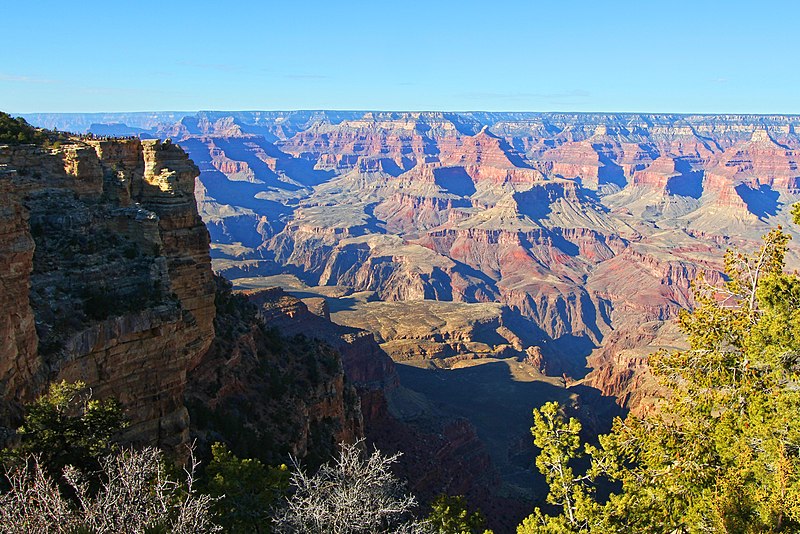
In northern Arizona, the Colorado River runs some 446 km through the Grand Canyon, about a mile deep and up to 29 km across, cutting down to rocks around 1.75 billion years old, and it became a national monument under Theodore Roosevelt in 1908 and a national park in 1919.
Most of the Grand Canyon’s nearly 5 million visitors a year see it from the South Rim, along the Rim Trail and from the Desert View Watchtower, since the North Rim’s historic Grand Canyon Lodge burned in the Dragon Bravo Fire in July 2025 — and the glass Skywalk is outside the park, on Hualapai land.
How old the Grand Canyon is remains a live argument — some geologists date stretches to 70 million years ago, others say the river joined them up only 5–6 million years ago — and in 1956 a mid-air collision above it killed 128 people and led to the creation of the Federal Aviation Agency in 1958.
5 – Diamond Head – Hawaii
(Click here to see more of this state)
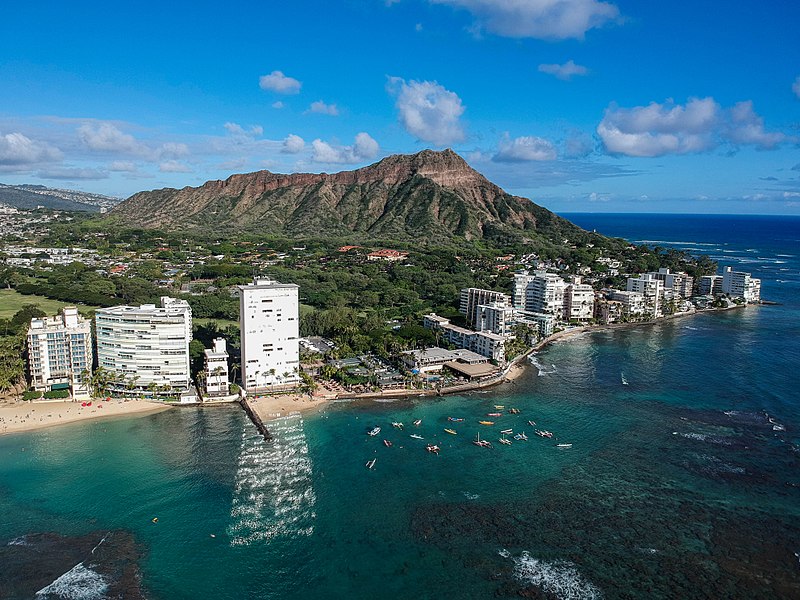
On the south shore of Oʻahu above Waikīkī, Diamond Head is a volcanic tuff cone called Lēʻahi, “brow of the tuna”, in Hawaiian, and from 1904 the US Army turned it into a fortress, with coastal guns at Fort Ruger and a fire-control station on the summit.
The Diamond Head summit trail, built in 1908 for the army, climbs to the crater rim through tunnels and past old bunkers to views over Waikīkī and Honolulu, and since May 2022 visitors from outside Hawaii need a reservation.
Diamond Head is named for calcite crystals that 19th-century British sailors mistook for diamonds, and nobody agrees quite how old it is — Hawaii’s state parks say about 300,000 years, other sources 400,000 to 500,000.
6 – Sawtooth Valley – Idaho
(Click here to see more of this state)
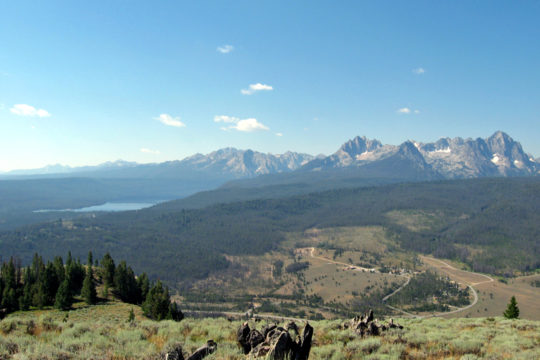
In central Idaho, the Sawtooth Valley holds the headwaters of the Salmon River, the “River of No Return”, beneath the jagged Sawtooth Range, and since 1972 it has been protected as the Sawtooth National Recreation Area.
Sawtooth Valley’s Redfish Lake, named for the sockeye that once turned it red, lies beside the tiny town of Stanley, often among the coldest places in the lower 48, and since 2017 the area has been part of the first International Dark Sky Reserve in the US.
Idaho’s sockeye swim more than 900 miles and climb over 6,500 feet from the Pacific to reach Redfish Lake, and in 1992 a single fish made it — “Lonesome Larry”, whose milt went to a hatchery programme and who ended up mounted in the governor’s office.
7 – Glacier National Park – Montana
(Click here to see more of this state)
Along the Continental Divide in north-west Montana, Glacier National Park was created in 1910 on land the Blackfeet sold to the US in 1895 — some Blackfeet say it was only leased — and in 1932 it joined Canada’s Waterton Lakes in the world’s first international peace park.
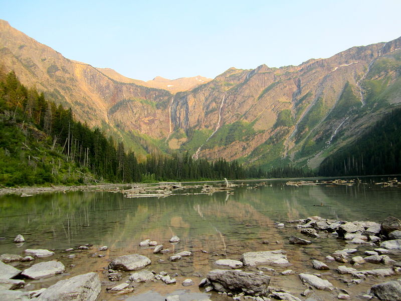
Glacier’s Going-to-the-Sun Road, dedicated in 1933, crosses the Divide at Logan Pass, red 1930s buses still carry visitors over it, and Avalanche Lake, pictured, is a walk of about 2 miles from the Trail of the Cedars — and for 2026 the park dropped its vehicle reservations.
Glacier’s much-quoted fall from 150 glaciers to 26 compares different size thresholds — like for like it’s about 80 to 26 — and the park’s signs saying the glaciers would be gone by 2020 were replaced when the ice proved slower to melt, though it is still shrinking.
8 – Niagara Falls – New York
(Click here to see more of this state)
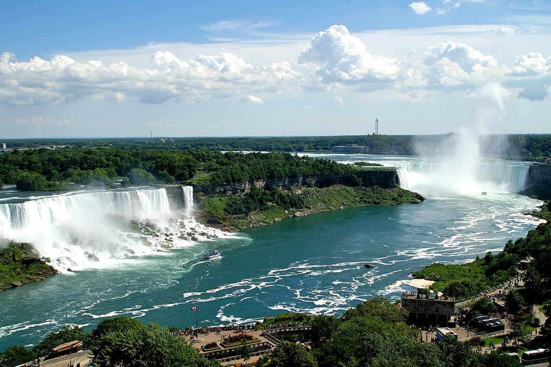
On the US side of the Niagara River, the American and Bridal Veil falls are protected by the Niagara Reservation, opened in 1885 after Frederick Law Olmsted’s “Free Niagara” campaign and claimed as the oldest state park in the country.
From Goat Island and Prospect Point you look down on the American Falls, the Maid of the Mist has carried visitors since 1846, and the Cave of the Winds tour leads to wooden decks at the foot of Bridal Veil Falls — the cave itself is long gone.
In 1969 the US Army Corps of Engineers turned the American Falls off for months to study rockfall, the Adams plant of 1895 was the first large-scale AC hydroelectric station, not the world’s first hydro plant as is often said, and on 1 June 1866 Irish Fenians under John O’Neill of Co. Monaghan crossed from Buffalo to invade Canada.
9 – Gettysburg – Pennsylvania
(Click here to see more of this state)
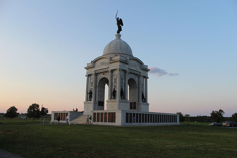
In southern Pennsylvania, Gettysburg was the scene of the Civil War’s largest battle, fought on 1–3 July 1863 and ending with the failure of Pickett’s Charge, at a cost of some 51,000 killed, wounded, captured or missing, about 7,000 of them killed.
Gettysburg National Military Park, created in 1895, has some 1,300 monuments and markers across Little Round Top, Devil’s Den, the Wheatfield and Cemetery Ridge, and at the Soldiers’ National Cemetery Lincoln gave his address of about 272 words on 19 November 1863 — not drafted on an envelope on the train, as the myth goes.
At Gettysburg Fr William Corby gave the Irish Brigade general absolution before it went into the Wheatfield on 2 July, Col. Patrick O’Rorke from Co. Cavan was killed leading the 140th New York on Little Round Top, and on 3 July the Philadelphia Irish of the 69th Pennsylvania held their wall at the Angle.
10 – Mount Rushmore – South Dakota
(Click here to see more of this state)
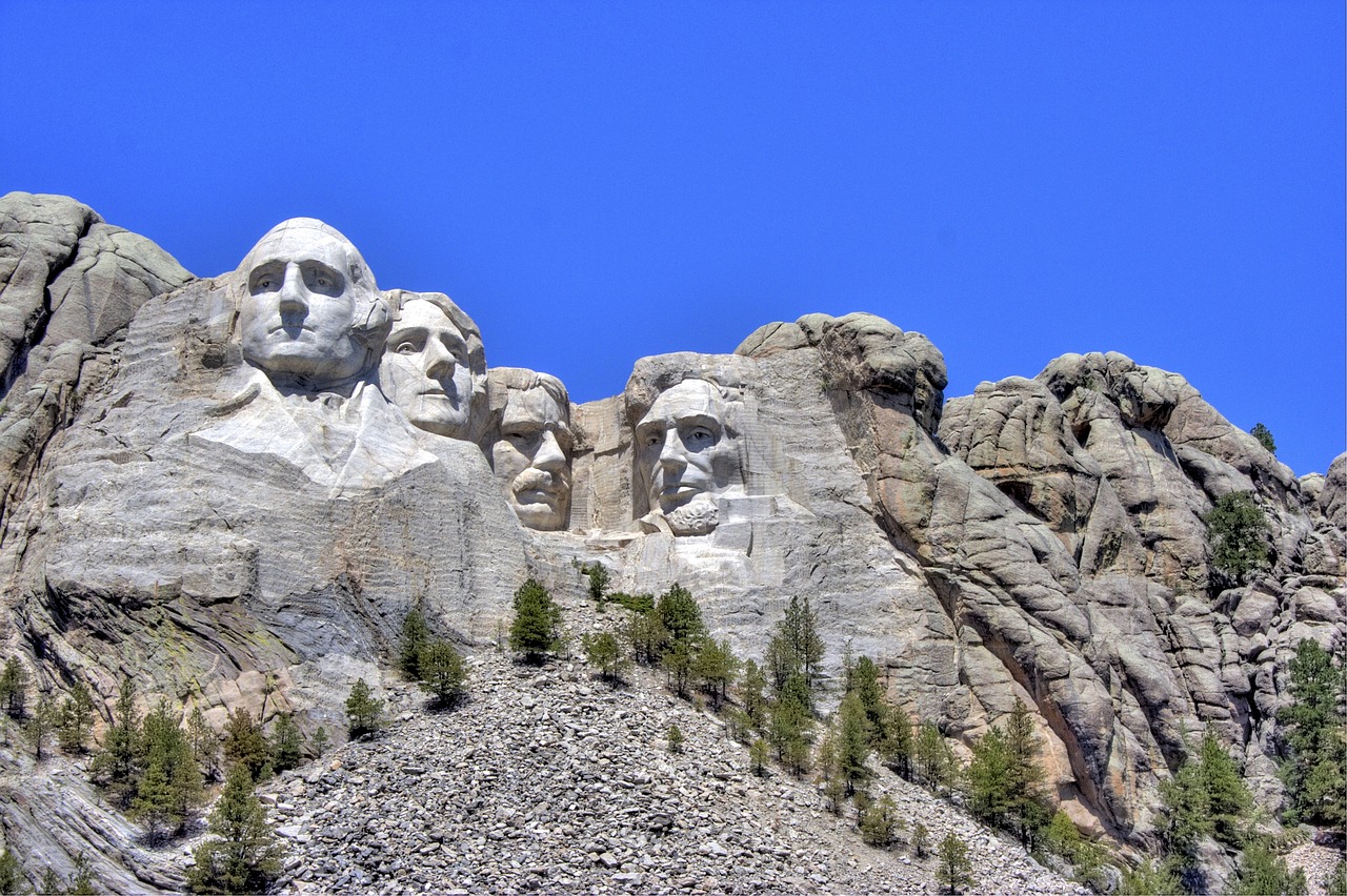
In the Black Hills, Mount Rushmore was carved from 1927 to 1941 by about 400 workers under Gutzon Borglum, who died months before it was finished, on a mountain the Lakota knew as the Six Grandfathers, in hills guaranteed to them by treaty in 1868 and taken by Congress in 1877 after gold was found.
Mount Rushmore’s 18-metre faces of Washington, Jefferson, Theodore Roosevelt and Lincoln look out from the granite, and down the road the Crazy Horse Memorial, begun in 1948, is still being carved.
The figures at Mount Rushmore were meant to reach the waist until the money ran out, Jefferson was first carved on Washington’s other side and blasted off when the rock proved unsound, and in 1980 the Supreme Court awarded the Sioux over $100 million for the Black Hills — money they have refused, since taking it would end their claim to the land.
11 – Palo Duro Canyon State Park – Texas
(Click here to see more of this state)
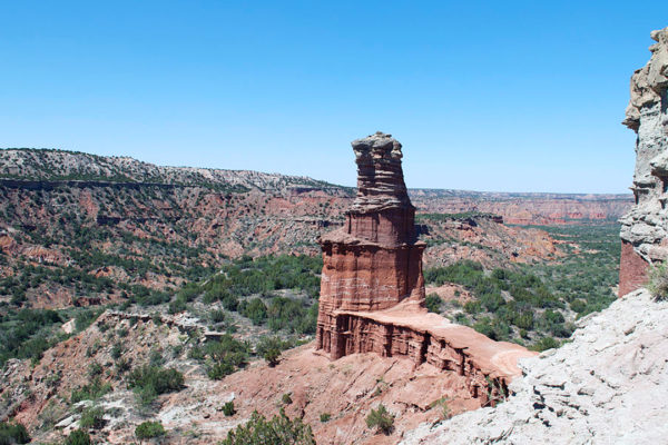
In the Texas Panhandle near Amarillo, Palo Duro Canyon runs about 190 km and drops some 240 metres, and on 28 September 1874 Colonel Ranald Mackenzie’s cavalry attacked Comanche, Kiowa and Cheyenne camps here and destroyed more than 1,000 of their horses, effectively ending resistance on the Southern Plains.
Palo Duro Canyon State Park, opened in 1934 with roads and trails built by the Civilian Conservation Corps, leads to the Lighthouse rock formation, the outdoor musical TEXAS has played here every summer since 1966, and Georgia O’Keeffe painted the canyon while teaching nearby in 1916–18.
The canyon’s JA Ranch, founded in 1877 by Charles Goodnight, was named for his partner John George Adair — an Irish landlord from Co. Laois, not the “English aristocrat” of Texas guides — who in 1861 had evicted 244 people at Derryveagh, Co. Donegal, before building Glenveagh Castle.
12 – Shenandoah National Park – Virginia
(Click here to see more of this state)
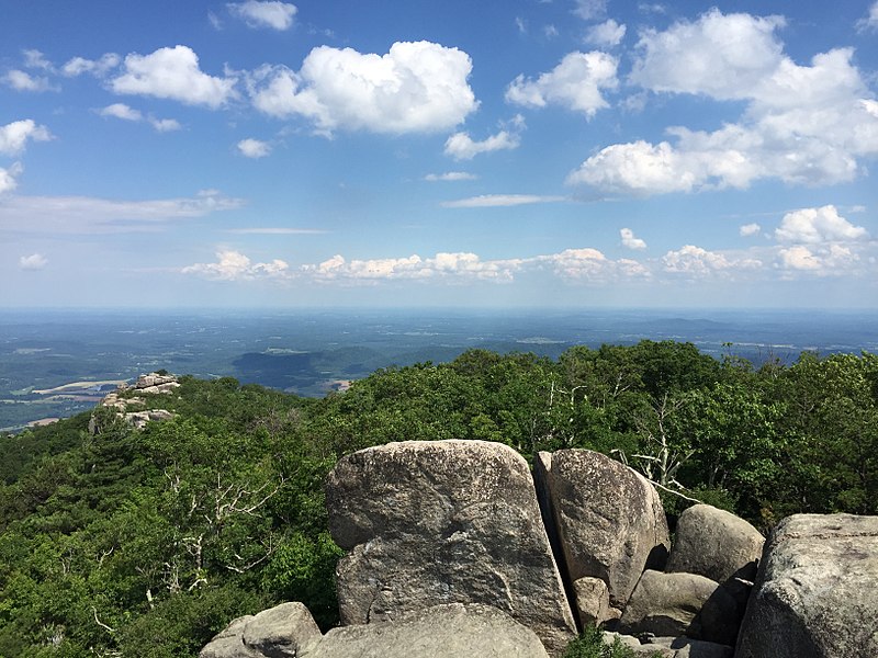
Along the crest of Virginia’s Blue Ridge, Shenandoah National Park was established in 1935 on land taken from about 465 families through state condemnation, and its facilities were segregated until desegregation was completed in 1950.
Shenandoah’s Skyline Drive runs 105 miles along the ridge, built from 1931 to 1939 with Civilian Conservation Corps labour, the Appalachian Trail runs through the park for 101 miles, and Old Rag Mountain, pictured, has a rock scramble that needs a $2 day ticket from March to November.
The romantic translation of Shenandoah as “daughter of the stars” has no sound basis — the name’s origin is uncertain — and from the 1730s the valley below was settled by Ulster Scots coming down from Pennsylvania, while Herbert Hoover’s Rapidan Camp survives inside the park as a presidential retreat.
13 – Mount Rainier National Park – Washington
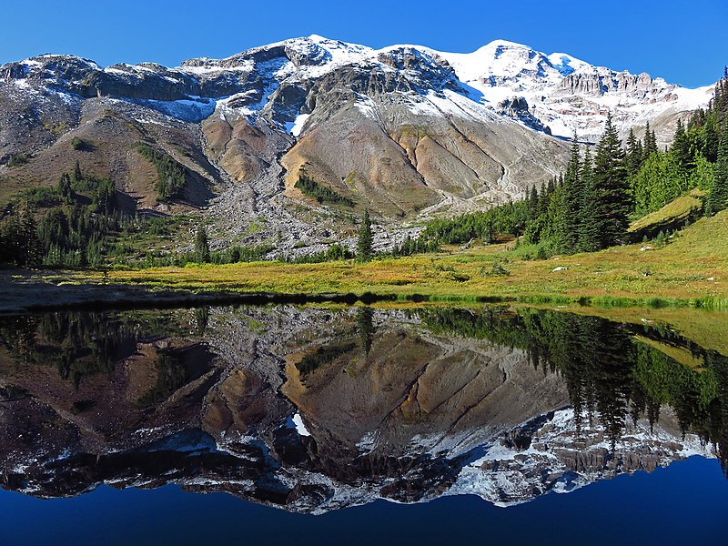
(Click here to see more of this state)
In the Cascade Range south-east of Seattle, Mount Rainier is an active volcano of about 4,390 metres, the most heavily glaciated peak in the lower 48, and in 1899 it became the fifth national park in the US.
Mount Rainier’s Paradise area is known for summer wildflower meadows below the glaciers, and the Wonderland Trail circles the whole mountain, past high valleys like Glacier Basin, pictured.
George Vancouver named Mount Rainier in 1792 for his friend Rear Admiral Peter Rainier, though it has at least 20 Indigenous names, among them Tahoma, Paradise’s 28.5 metres of snow in 1971–72 was a world record until Mount Baker beat it in 1999, and some 80,000 people live in areas at risk from its mudflows.
14 – Grand Teton National Park – Wyoming
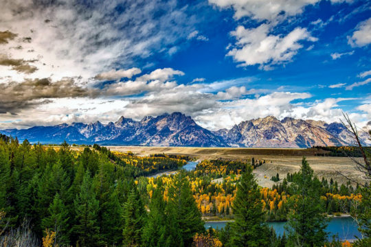
(Click here to see more of this state)
Rising straight out of Jackson Hole in north-west Wyoming, the Teton Range is the youngest in the Rockies, uplifted over the last 9–10 million years, and the Grand Teton, 4,199 metres, takes its name from French-speaking trappers’ “les trois tétons”, the three breasts.
Grand Teton’s sights include Jenny Lake, the barns of Mormon Row and the Snake River Overlook, where Ansel Adams took his 1942 photograph The Tetons and the Snake River, which was sent into space on the Voyager Golden Record in 1977.
Grand Teton National Park reached its present size only in 1950, after John D. Rockefeller Jr. secretly bought up the valley floor and FDR’s 1943 national monument provoked a protest cattle drive by armed ranchers, and Jackson Hole is named after the trapper Davey Jackson, whose grandfather, family tradition says, came from near Coleraine.
15 – Royal Gorge Bridge – Colorado
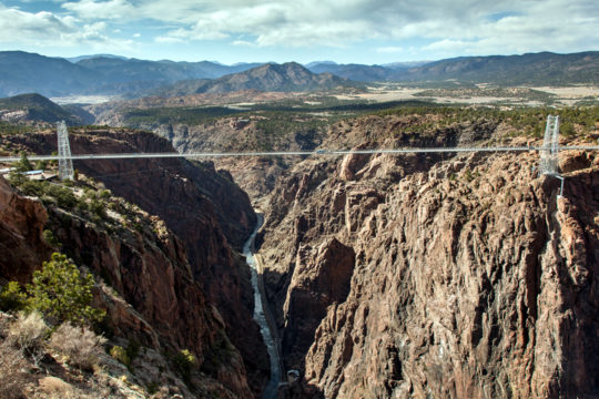
(Click here to see more of this state)
Near Cañon City in south-central Colorado, the Royal Gorge Bridge was built in about six months in 1929 purely as a tourist attraction, 291 metres above the Arkansas River, and it was the world’s highest bridge until China’s Liuguanghe Bridge opened in 2001.
The Royal Gorge Bridge is still the highest bridge in the US, its park adds an aerial gondola and the Cloudscraper zip line, billed as America’s highest, and trains still run along the floor of the gorge far below.
In 1878–80 two railways fought the Royal Gorge Railroad War over the only route through the gorge, with the Santa Fe hiring Bat Masterson, and in June 2013 a wildfire destroyed 48 of the park’s 52 buildings, though the bridge survived with some deck planks burned.
16 – Toccoa Falls – Georgia
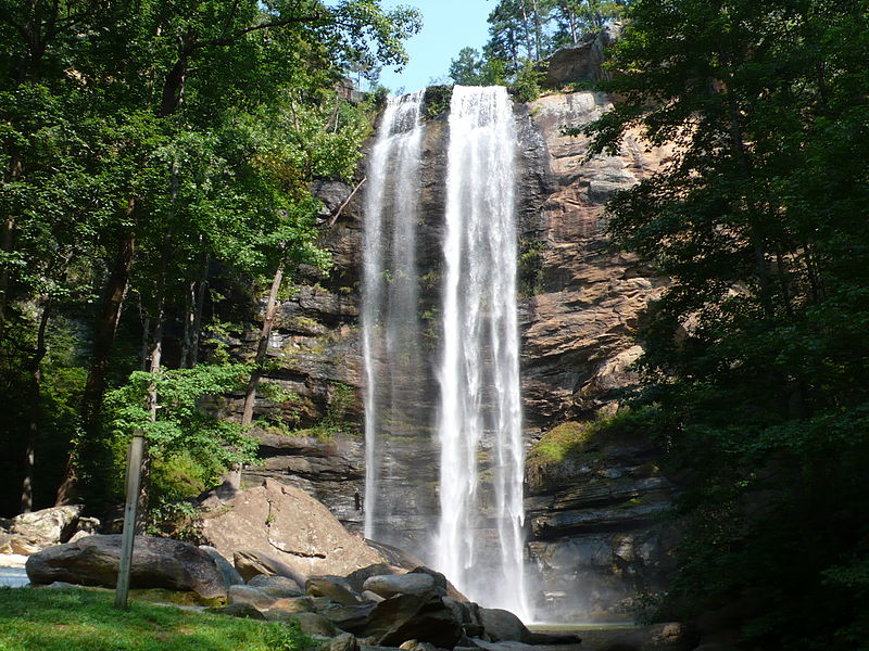
(Click here to see more of this state)
In north-east Georgia, Toccoa Falls drops 57 metres, further than Niagara, on the campus of what became the University of Toccoa Falls in July 2026, and its name is usually traced to a Cherokee word meaning “Catawba place” rather than the “beautiful” often quoted.
Visitors reach Toccoa Falls through the university’s gift shop, for a small fee, then a short path to the foot of the falls, and nearby Currahee Mountain was the “three miles up, three miles down” training run of the Band of Brothers paratroopers at Camp Toccoa in the Second World War.
At about 1:30am on 6 November 1977 the Kelly Barnes Dam above Toccoa Falls gave way after days of rain and the flood killed 39 people at what was then Toccoa Falls Bible College, and within weeks President Carter ordered an inspection of some 9,000 high-hazard dams across the country.
17 – Chimney Rock State Park – North Carolina
(Click here to see more of this state)
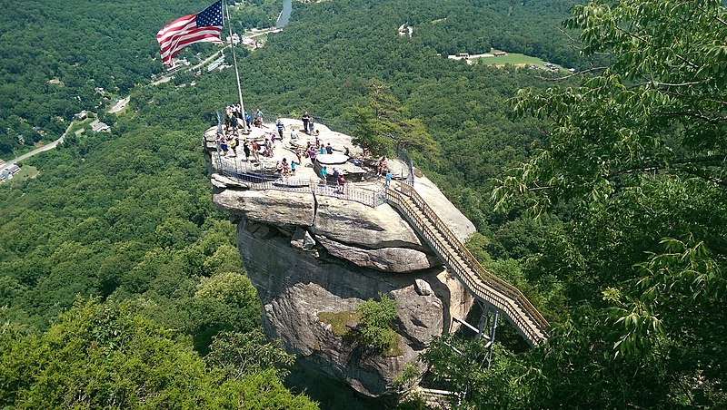
In Hickory Nut Gorge in North Carolina’s Blue Ridge, Chimney Rock is a 96-metre rock spire that the Morse brothers bought for $5,000 in 1902 and ran as a private attraction until the state bought it in 2007 to make a state park.
Chimney Rock’s elevator of 1949 rises about 258 feet through the rock, the Outcroppings Trail climbs 499 steps, and another trail leads to Hickory Nut Falls, about 404 feet high, where the final fight of The Last of the Mohicans (1992) was filmed.
Hurricane Helene’s floods on 27 September 2024 wrecked the village below and the park’s access bridge, and Chimney Rock reopened on 27 June 2025 — while nearby Lake Lure hosted Dirty Dancing, though its famous lift in the lake was actually shot at Mountain Lake in Virginia.
18 – Washington D.C.
(Click here to see more of this state)
On the Potomac between Maryland and Virginia, Washington was laid out as the federal capital in the 1790s, and its White House was designed by James Hoban from near Callan, Co. Kilkenny, believed to have modelled it on Leinster House in Dublin, who rebuilt it after the British burned it in 1814.
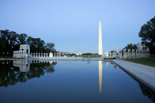
Washington’s Monument, pictured, about 169 metres, anchors the National Mall between the Capitol and the Lincoln Memorial, lined by the Smithsonian’s free museums, and St Patrick’s, founded in 1794 for the Irish stonemasons building the White House and Capitol, is the oldest parish in the federal city.
The Washington Monument changes colour about a third of the way up because building stopped for some 20 years after 1854, when a stone sent by Pope Pius IX was stolen — blamed on the anti-Catholic Know-Nothings, though no one was charged — and DC’s height limit is set by street width, not by the Capitol, as is often said.