
Wikimedia Commons / CC-BY-SA-3.0 / GFDL
Capital: Ottawa
Population: 41.8 million+
Language: English, French, Inuit.
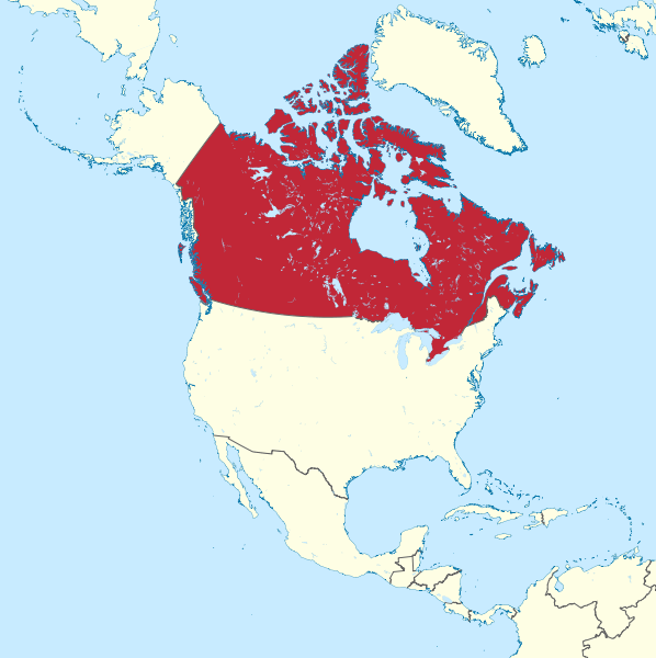
Click here to see each Canadian state.
1 – Alberta (also above)
(click here to see more of this state)
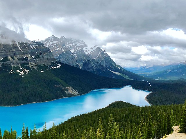
High in Banff National Park, Peyto Lake lies below Bow Summit, the highest point on the Icefields Parkway, in the park Canada created in 1885 when the government reserved the Cave and Basin hot springs — long used by Indigenous peoples — after three railway workers tried to claim them for themselves.
A short trail leads to the viewing platform rebuilt in 2021, looking down on Peyto Lake’s turquoise water, coloured by fine rock flour washed in from the Peyto Glacier, with the Mistaya valley running away north beyond it.
Peyto Lake is named for Bill Peyto, a Kent-born guide and later park warden who was wounded at Ypres and who, so the story goes, once cleared a Banff bar by walking in with a live lynx — while the glacier that colours the water has been measured since 1965 and has shrunk by about a quarter in area since the 1960s.
2 – British Columbia
(click here to see more of this state)
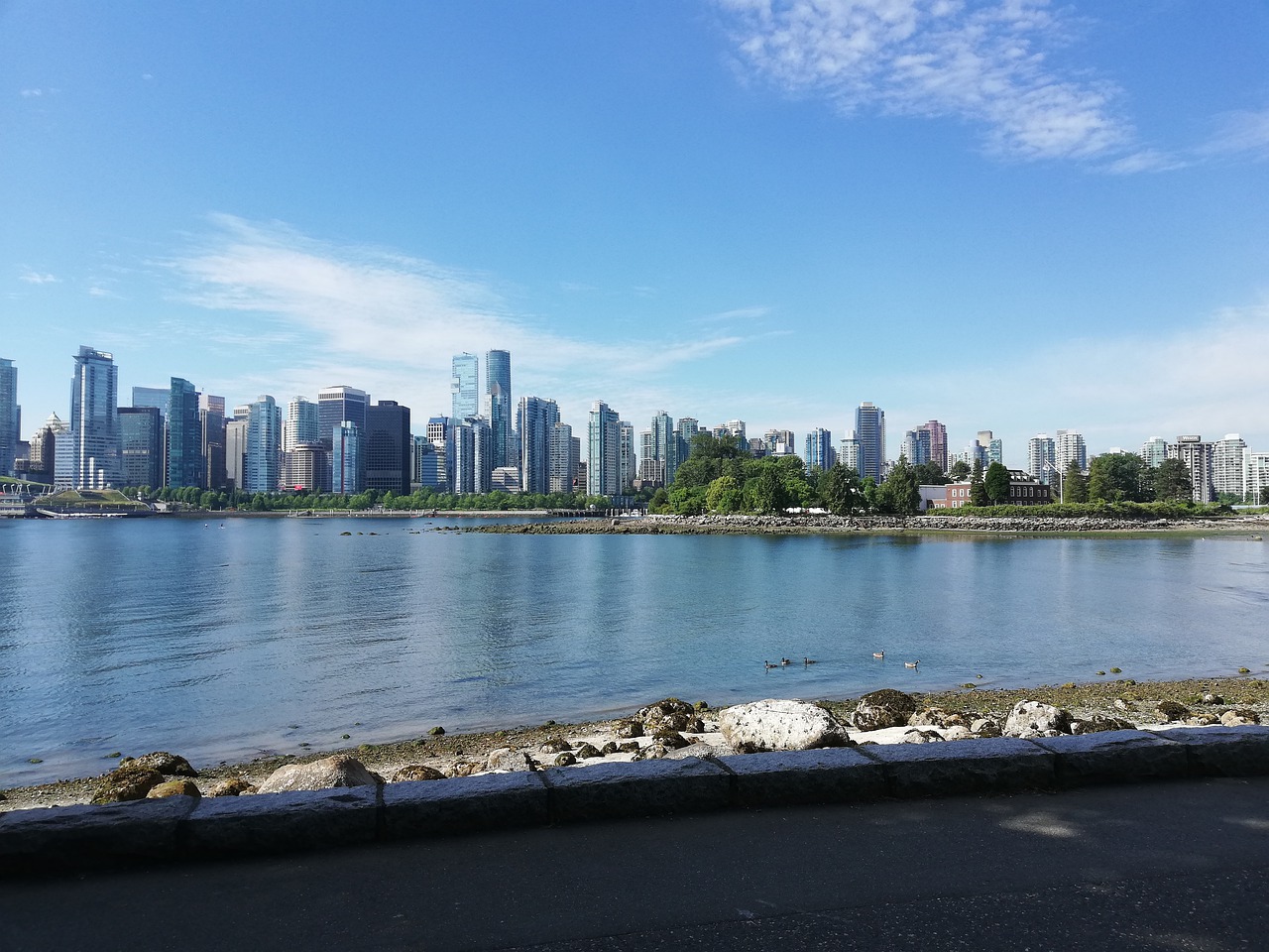
On Burrard Inlet in British Columbia, Vancouver was incorporated on 6 April 1886 and named by the Canadian Pacific Railway’s William Van Horne after Captain George Vancouver, and in 2014 the city council formally acknowledged that it stands on the unceded territory of the Musqueam, Squamish and Tsleil-Waututh Nations.
Start in Gastown, which grew up around “Gassy” Jack Deighton’s 1867 saloon, then walk or cycle the seawall round Stanley Park, opened in 1888 and at 405 hectares about a fifth bigger than New York’s Central Park, and finish at Canada Place, a legacy of Expo 86.
Nine weeks after incorporation, the Great Fire of 13 June 1886 burned Vancouver almost flat in under an hour — the death toll was never established — and the rebuilt city now doubles for everywhere else on screen, most famously as the rain-soaked backdrop to the first five seasons of The X-Files.
3 – Manitoba

(click here to see more of this state)
On the Grass River in northern Manitoba, south of the nickel town of Thompson, Pisew Falls sits on a waterway that was part of the fur traders’ route inland from York Factory on Hudson Bay, travelled by Samuel Hearne in 1774 and mapped by David Thompson from the 1790s.
A short boardwalk leads to the viewing platform above Pisew Falls’ 13-metre drop, and from there a long day’s hike follows the river downstream to Kwasitchewan Falls, generally considered the highest waterfall in Manitoba.
Pisew is Cree for lynx, after the hiss of the water, and Thompson exists only because Inco found a nickel ore body there on 4 February 1956 — by 1962 the new town was turning out about 11% of the world’s finished nickel.
4 – New Brunswick
(click here to see more of this state)
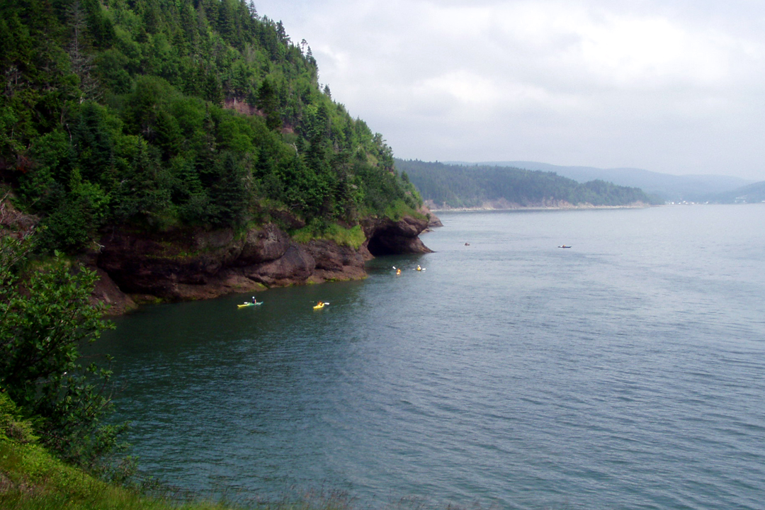
On New Brunswick’s Bay of Fundy coast, Fundy National Park was proclaimed in 1948 and opened in 1950 on land taken from dozens of families at Point Wolfe, Alma West, Hastings and Herring Cove, whose communities were cleared — Parks Canada now gives their descendants free entry.
At Alma Beach the tide rises and falls by up to 12 metres and pulls back more than a kilometre at low water, and inland Fundy National Park has waterfalls, forest trails and the Point Wolfe covered bridge, rebuilt in 1992 after road-work blasting sent a rock onto the original.
The bay’s record tides are actually across the water at Burntcoat Head in Nova Scotia, closely rivalled by Ungava Bay in northern Quebec, and the flowerpot-shaped Hopewell Rocks on every Fundy poster aren’t in Fundy National Park at all — they’re a separate provincial site roughly halfway to Moncton.
5 – Newfoundland
(click here to see more of this state)
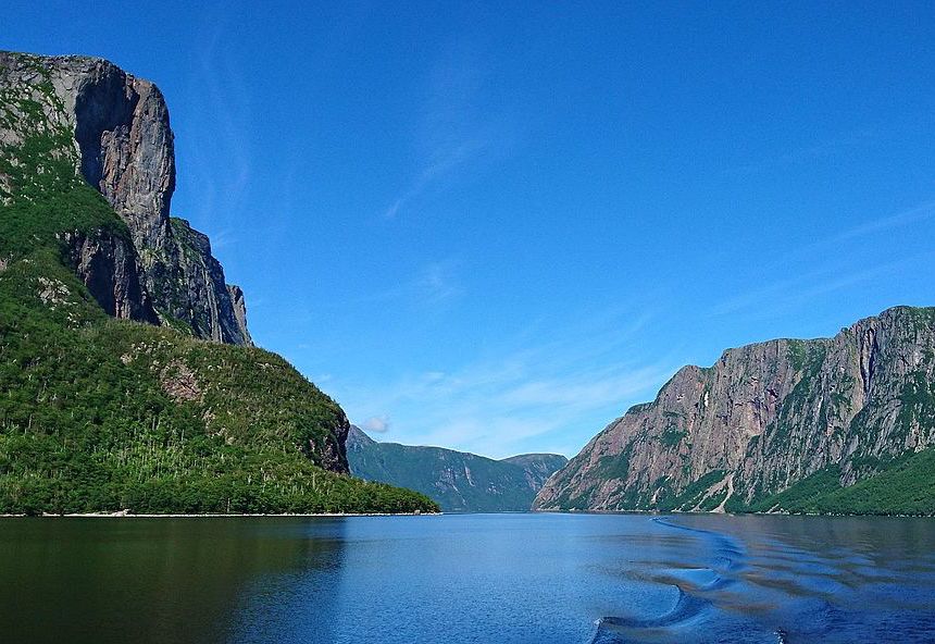
In Gros Morne National Park on Newfoundland’s west coast, Western Brook Pond is a landlocked fjord, carved by glaciers and then cut off from the sea as the land rose after the ice melted, in a park UNESCO listed in 1987 because rocks from the Earth’s mantle lie exposed at the surface.
A 3 km trail across bog and forest leads to the dock for the boat trip up Western Brook Pond’s 16 km gorge, between cliffs around 600 metres high, past Pissing Mare Falls, which drops some 340 metres in all.
About 60% of Western Brook Pond’s water lies below sea level yet it’s entirely fresh, and so low in nutrients that scientists class it as ultra-oligotrophic — while the province around it only joined Canada in 1949, after a 52% referendum vote, and only added “and Labrador” to its name in 2001.
6 – Northwest Territories
(click here to see more of this state)
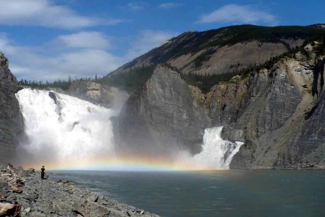
On the South Nahanni River in the Northwest Territories, Virginia Falls — Náįlįcho in Dene — lies in Nahanni National Park Reserve, one of the first twelve places UNESCO inscribed as World Heritage Sites in 1978 and now managed jointly with the Dehcho First Nations.
There’s no road, so you arrive by chartered floatplane, mostly from Fort Simpson, and walk out to the viewpoints over Virginia Falls’ 96-metre drop — about twice the height of Niagara’s Horseshoe Falls — split around a central spire of rock.
An American, Fenley Hunter, named Virginia Falls after his daughter in 1928, and the region’s “Headless Valley” legend — two prospecting brothers supposedly found decapitated around 1908 — was already being called folklore by 1947, when Maclean’s reported they hadn’t been decapitated at all.
7 – Nova Scotia
(click here to see more of this state)
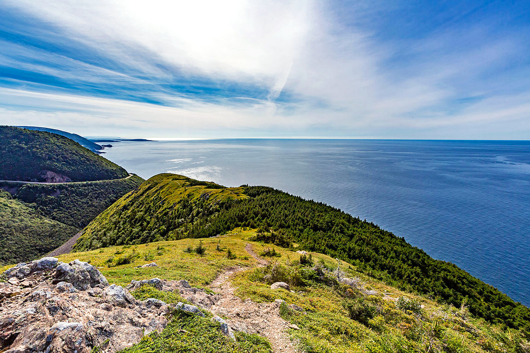
At Nova Scotia’s north-eastern end, Cape Breton Island — Unama’ki to the Mi’kmaq — holds the Fortress of Louisbourg, founded by France in 1713, taken by the British in 1745 and again in 1758, and then deliberately demolished by them from 1760.
Drive the 298 km Cabot Trail around the highlands through Cape Breton Highlands National Park, Atlantic Canada’s first national park in 1936, then give a day to Louisbourg, where about a fifth of the town has been rebuilt since 1961, partly by out-of-work coal miners.
Nobody knows whether John Cabot ever saw the Cape Breton coast the trail is named after — no first-hand record of his 1497 landfall survives, and Canadian historians mostly favoured Cape Breton until 1949, when Newfoundland joined Canada and the official honours went to Bonavista.
8 – Nunavut
(click here to see more of this state)
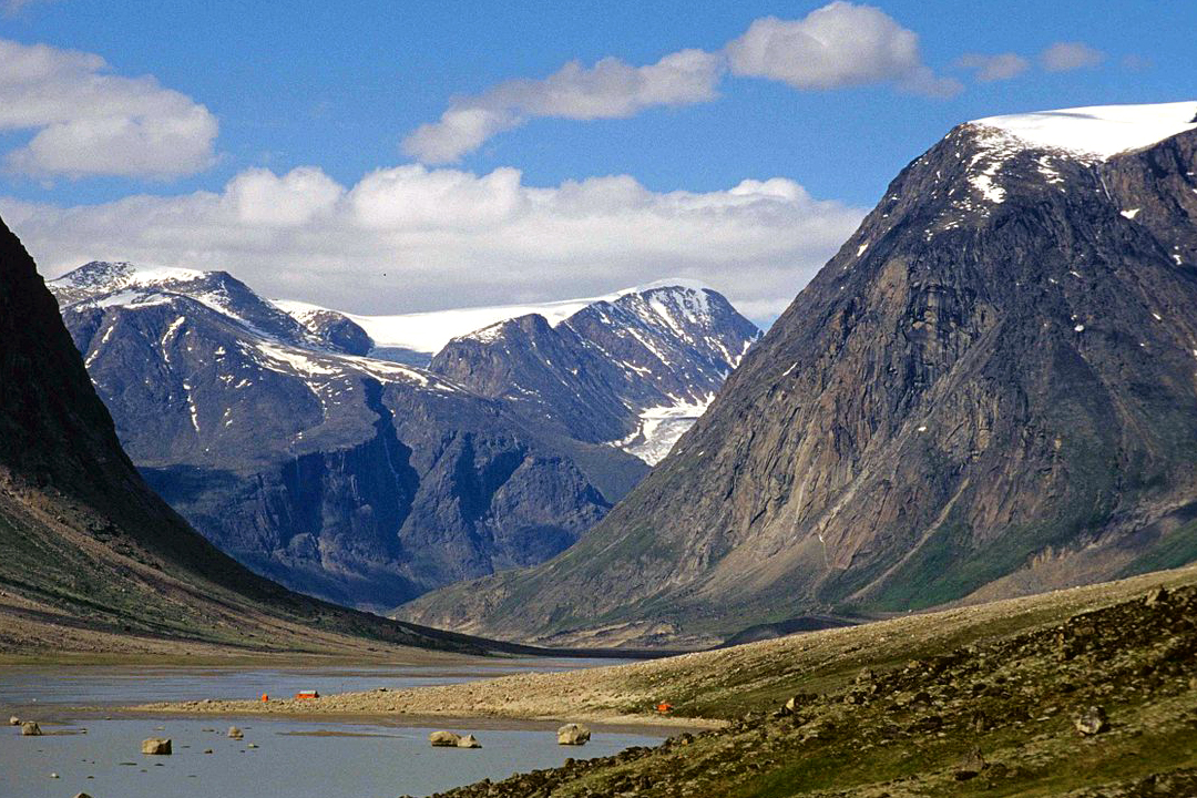
On a fjord off Cumberland Sound on Baffin Island, Pangnirtung — Pangniqtuuq, “the place of bull caribou” — is an Inuit community of about 1,500 that grew around a Hudson’s Bay Company post opened in 1921, in a territory that has existed only since 1 April 1999.
Pangnirtung is the gateway to Auyuittuq National Park and the Akshayuk Pass, beneath Mount Thor, whose 1,250-metre overhanging face Guinness recognises as the world’s greatest vertical drop, and by boat to the whaling station on Kekerten Island, where Scottish and American whalers worked from 1857.
The German scientist Franz Boas spent 1883–84 among the Inuit of Cumberland Sound, the year generally credited with turning him from geography to culture and helping shape modern anthropology — and since 1970 Pangnirtung has been known for the tapestries woven in its own studio.
9 – Ontario
(click here to see more of this state)
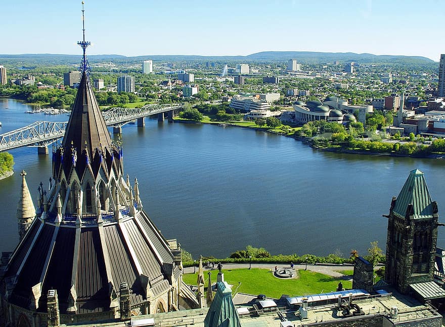
On a cliff above the Ottawa River — the Outaouais, which divides Ontario from Quebec — Parliament Hill stands in a city that began as Bytown, was renamed Ottawa in 1855, and was chosen as capital by Queen Victoria in 1857 on her Governor General’s advice that it straddled English and French Canada and lay further from the American border than its rivals.
Centre Block and the Peace Tower are shut for a renovation not expected to finish until the early 2030s, so tours go to the House of Commons in the West Block and the Senate’s temporary home on Rideau Street, a short walk from the Rideau Canal, a World Heritage Site since 2007.
When Centre Block burned on 3 February 1916, killing seven, the Library of Parliament survived because a clerk shut the iron doors the librarian had insisted on decades earlier — which is why the round library at the back of Parliament Hill is the only part of the original building still standing.
10 – Prince Edward Island
(click here to see more of this state)
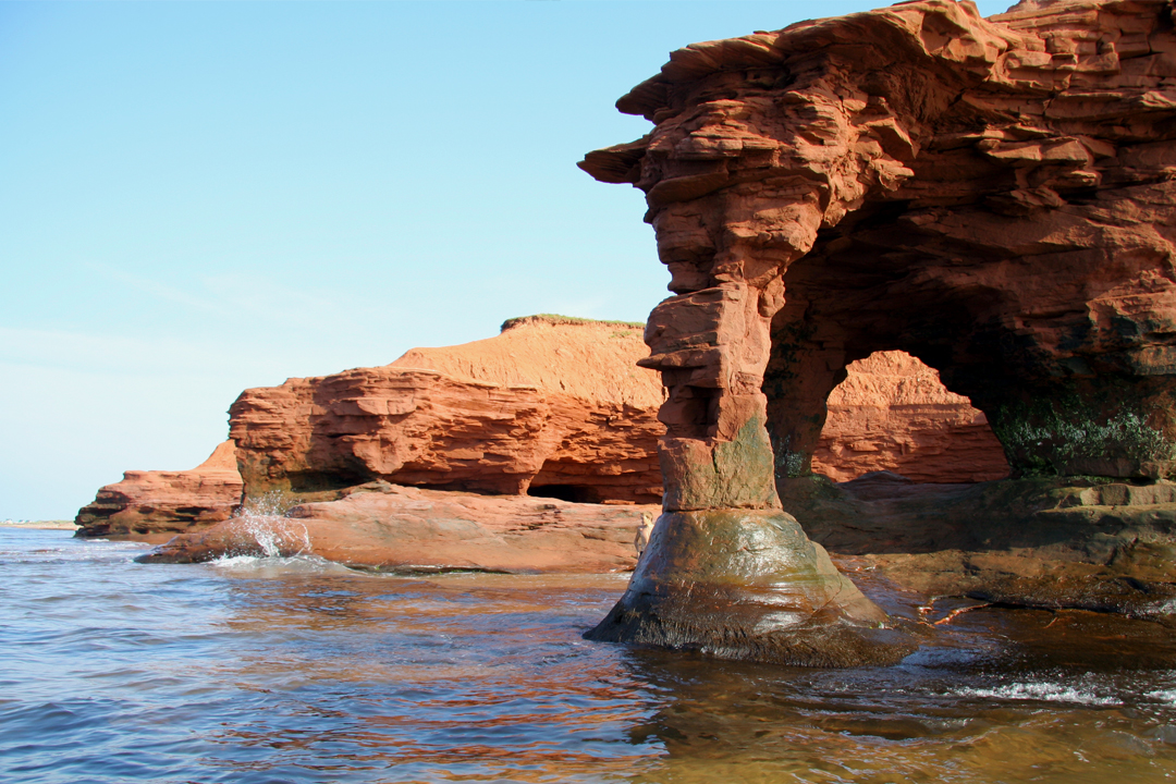
Prince Edward Island hosted the 1864 Charlottetown Conference that set Confederation in motion, then refused to join Canada itself until 1873, when railway debts left it little choice — and its red sandstone shore is where the island’s famous sea arches stood.
Prince Edward Island’s best-known arches are gone — Teacup Rock at Thunder Cove fell in post-tropical storm Fiona in September 2022 and the MacKenzie’s Brook arch at Cavendish followed that November — so come for the red cliffs, the dunes of PEI National Park and the Green Gables farmhouse at Cavendish.
The soft sandstone is cut back by the sea at roughly 30 cm a year on average, which is why PEI’s arches never last, and the island’s more durable export is Anne of Green Gables, published in 1908 and on Japanese school reading lists since the early 1950s.
11 – Quebec

(click here to see more of this state)
On the cliff of Cap Diamant above the St Lawrence, the Château Frontenac opened in 1893 as a Canadian Pacific Railway hotel inside Old Québec, the city Champlain founded in 1608, whose surviving ramparts UNESCO describes as unique north of Mexico.
Walk the Dufferin Terrace boardwalk in front of the Château Frontenac, then the walls and gates, Place Royale in the lower town — which stood in for France in Catch Me If You Can — and the Plains of Abraham, where Wolfe and Montcalm were both mortally wounded on 13 September 1759.
In August 1943 the Château Frontenac housed the British delegation to the Quebec Conference, where Churchill and Roosevelt, staying up the hill at the Citadelle, agreed to plan the Normandy landings while the host prime minister, Mackenzie King, was kept out of the strategy talks.
12 – Saskatchewan
(click here to see more of this state)
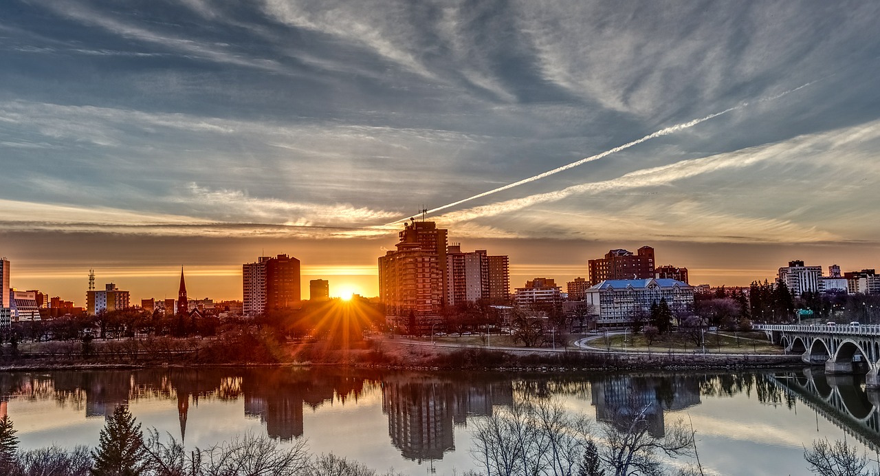
On the South Saskatchewan River, Saskatoon was picked in 1882 as the site of a Methodist temperance colony from Toronto, took its name from the Cree word for the saskatoon berry, and became a city in 1906.
Saskatoon’s riverbanks are linked by eight road and pedestrian bridges — hence “City of Bridges” — overlooked by the railway-castle Bessborough Hotel, finished in 1932 but left unopened until 1935 by the Depression, and just north of town is Wanuskewin Heritage Park, a gathering place for some 6,000 years.
Bison were returned to Wanuskewin in December 2019, and the next summer their wallowing exposed rock carvings nobody had known were there, strengthening the site’s bid for UNESCO listing — and Joni Mitchell, though born in Alberta, calls Saskatoon her hometown.
13 – Yukon
(click here to see more of this state)
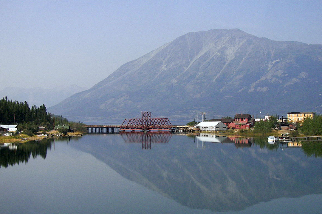
On the narrows between Bennett and Nares lakes in southern Yukon, Carcross was Caribou Crossing until mail mix-ups with other Caribous led Bishop Bompas to ask for a new name in the early 1900s, and it’s the home of the Carcross/Tagish First Nation.
The White Pass & Yukon Route railway’s last spike was driven at Carcross on 29 July 1900 — the gold spike was bent in the ceremony and quietly pulled out afterwards — and today there’s the station, the Matthew Watson General Store, one of the Yukon’s longest-running businesses, and Montana Mountain’s bike trails, rebuilt by Carcross/Tagish youth.
The Klondike strike of August 1896 was registered to George Carmack, but his party included Keish — Skookum Jim — of the Carcross/Tagish and Dawson Charlie, and the story widely told is that the claim went in Carmack’s name because officials might not accept an Indigenous discoverer.